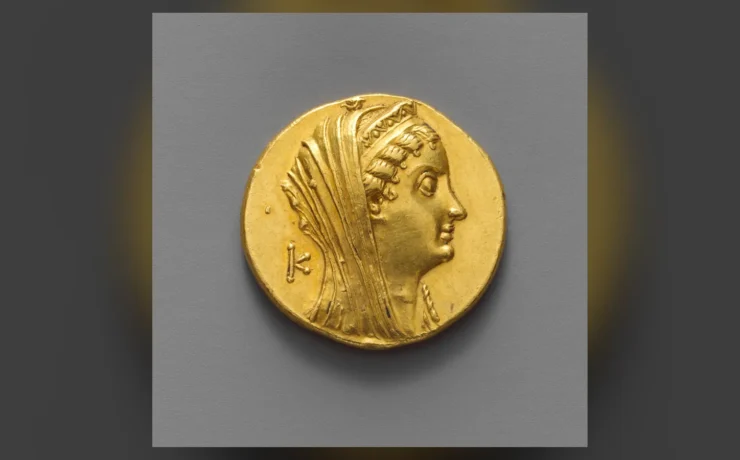
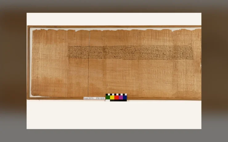
Fustat is essential to the history of Egypt after the seventh-century conquests, but it is too often reduced to the statement that it was the 'first Islamic capital'. Understanding Fustat means considering river geography, settlement and trade, administration, changing relations with older communities, and the ways in which later Cairo grew around successive political centres.
The seventh-century foundation and its setting
Following the Arab-Muslim conquest of Egypt, a new administrative settlement was established near the fortress of Babylon in the area of present-day Old Cairo. Fustat's rise reflected the strategic relationship between the Nile, overland routes and the administration of Egypt. Some sources give 641 or 642 CE for events associated with the new city; converting these into a single neat calendar date can obscure the sequence of military and administrative changes. Settlement developed near existing Egyptian communities and institutions rather than on a cultural blank slate. Archaeology can reveal construction, household equipment and occupation, while written accounts provide another perspective often compiled much later. Keeping these sources distinct helps reconstruct early Fustat without romanticizing or oversimplifying its origins.
A city of work, commerce and movement
Fustat's connections to the Nile and the routes linking Egypt with the Mediterranean, Red Sea and beyond contributed to its commercial importance. Houses, streets, workshops and products speak to daily life as much as administrative texts do. Craftspeople and merchants participated in long-distance trade networks whose scale varied across centuries. The city's material history cannot be narrated solely as a sequence of rulers. Changes in sanitation, water supply, building materials and land use can illuminate practical concerns of households and businesses. At the same time, archaeological survival is uneven: some areas were rebuilt, abandoned or transformed, while later Cairo's growth altered the urban landscape. The limited physical record requires cautious interpretation.
The setting beside Babylon of Egypt before 641
Fustat's story did not begin on empty land. The Nile-side region around the Roman fortress of Babylon had been occupied and reshaped for centuries before the Islamic conquest, with fortification, settlement and waterways forming a complicated urban landscape. Archaeological study has identified Roman and late antique features, including links to the Nile and the canal system that once connected the river with routes toward the Red Sea. The city's later identity as Egypt's first Islamic capital should not erase this older setting or the communities already living around it. The relationship between riverbank and buildings also changed through sedimentation and water-level movements. A modern street map can help locate the archaeological area, but cannot reproduce the shoreline or built environment of the seventh century. The site is therefore an excellent case for combining written history with archaeology rather than treating a foundation legend as the complete account of how a city came to exist.
The conquest, Amr ibn al-As and the foundation of the new capital
Egypt's Ministry of Tourism and Antiquities associates the founding of Fustat with 21 AH and gives 641 CE in its site narrative, while UNESCO's Historic Cairo summary gives 642 CE. Because the Hijri year and the sequence of conquest, settlement and construction do not map to a single universally agreed Gregorian label, the careful reference is approximately 641–642 CE rather than an exact day or uncontested single year. The decision to establish a capital away from Alexandria is a crucial political and geographical development in Egyptian history. Traditions connect the name Fustat to a tent or encampment associated with Amr ibn al-As, though a place-name story cannot by itself map the earliest settlement in detail. The military, administrative and fiscal circumstances of the conquest shaped the growth of the new centre. This process should not be written as if Egypt's population and institutions changed instantly. The settlement developed in a landscape already containing communities, fortifications and commercial activity. Historical chronicles, later topographical writing and excavated remains each help reconstruct different aspects of the foundation. A rigorous account identifies their different dates and limitations rather than merging them into one flawless eyewitness narrative.
The Mosque of Amr: continuous significance, changed architecture
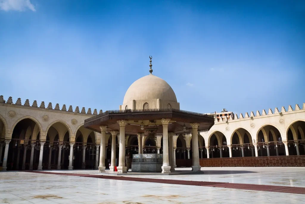
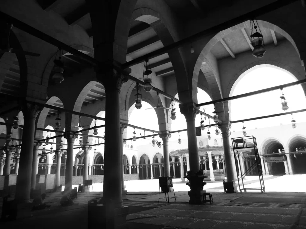
The Mosque of Amr ibn al-As is closely linked to Fustat's foundation and is widely identified as the first mosque established in Egypt. Its long history, however, includes substantial rebuilding and alteration. The structure that visitors photograph today is not a pristine seventh-century survival, and a picture of its current courtyard must be captioned accordingly. As the city changed, the mosque remained an important religious and public landmark. Its architectural transformations can tell us about later rulers, resources and changing communal needs, but they should not be used to invent precise features of the first prayer space. Wikimedia photographs from 2013 and 2014 provide authentic visual evidence of the mosque in those years. They do not give a time machine view of the initial settlement. A separate visitor guide may cover current worship and access arrangements, while the historical article explains the difference between institutional continuity and surviving masonry.
Urban districts, communities and social complexity
Early Fustat was not merely a military parade ground. Residential areas, commercial activities and social institutions evolved through interaction among different groups. Descriptions of the city's early districts sometimes reflect tribal and administrative arrangements, but archaeological deposits present a far more varied pattern of everyday spaces and successive rebuilding. Ethnic and religious identity did not map neatly onto every neighbourhood, and histories based only on governors or armies risk overlooking artisans, servants, scholars and families. The city's position near the Nile meant that movement of people, supplies and ideas could connect local households to wider regional networks. A credible map should show the approximate nature of reconstructed districts and identify when evidence comes from later authors. The lived city was changing even when political power shifted elsewhere. The most useful question is not merely who founded Fustat, but how its residents made it work as a place of habitation.
Markets, craft and the Nile port economy
Fustat's river setting supported commercial exchange and activities connected with transport, distribution and craft production. Ceramic finds provide particularly strong evidence for aspects of these economies. Scholars have studied changes in pottery manufacture, trade and settlement patterns using excavated kilns, production waste and later collections of glazed vessels. Yet the presence of a pot in a museum does not necessarily tell us where it was made, sold or used. Some ceramics circulated far beyond their production place, while other objects have incomplete collecting histories. Linking vessels to manufacturing waste, stratigraphy and workshop structures offers stronger evidence than stylistic resemblance alone. The riverbank itself shifted over time, influencing available land and the relationship between the port and urban fabric. Understanding this economic geography helps explain why different areas could change from residential use to production and back across centuries.
Archaeological ceramics as sources for urban change
The 2024 open-access study by Alison Gascoigne and Peter Sheehan, 'Sherds and the City', examines how pottery production and the built landscape of Fustat developed through different periods. It demonstrates why claims that the city was simply destroyed and abandoned are too blunt. Excavated evidence shows phases of reuse, new workshops and adaptations of former living spaces. Kilns, clay preparation areas and industrial waste can reveal particular activities, but their chronology must be tied to stratigraphic observations and other evidence. Researchers also revise earlier dates when methods or new data justify doing so. A museum catalogue that labels an object 'Fustat ware' may be useful for identifying ceramic traditions, but it cannot substitute for publication of the excavation context. This source-based approach makes a history of urban decline less melodramatic and more precise. The city did not pass through one single cycle of rise and ruin.
Communities, language and religious change
The spread of Arabic and Islam in Egypt happened over generations rather than all at once following a single battle. Coptic Christian communities continued to play important roles; Jewish history is also fundamental to understanding Fustat. The Cairo Geniza, associated with the Ben Ezra Synagogue in the Fustat area, preserves a vast documentary tradition that has transformed knowledge of commerce, households, learning and social relations across the medieval Mediterranean. Such records offer unusually detailed views beyond political chronicles. They also require interpretation, since surviving papers represent particular communities and circumstances rather than an exhaustive census. A serious history acknowledges different forms of cultural continuity and change without erasing any part of the population.
Fustat, al-Askar, al-Qata'i and Cairo
Medieval Egyptian urban history involves more than one political centre. The later foundations of al-Askar and al-Qata'i contributed to changing administrative geography before the Fatimids established Cairo in 969 CE. The Mosque of Ibn Tulun belongs to the late ninth-century al-Qata'i setting; it does not date to Fustat's original foundation. UNESCO identifies these successive settlements as important to the layered urban form of Historic Cairo. A map should show the relationship among them without treating every mosque within modern Cairo as evidence from the same century. Political institutions relocated, but human settlement and trading activity remained connected across the greater urban landscape.
How Fustat's remains should be read today
Historical reconstruction depends on archaeological reports, documents and careful identification of surviving sites. The modern visitor encounters Old Cairo, Coptic heritage, Islamic monuments and later urban fabric together; this is a benefit for cultural experience but a source of chronological confusion if buildings are not dated. A heritage guide can suggest where to visit, while the historical article should identify the evidence behind claims about each phase. Respect active religious spaces, verify visitor access and distinguish a medieval textual description from a present-day landmark. The development of Fustat is a story of successive communities, not a single architectural postcard.
The Cairo Geniza and documentary traces of ordinary life
Documents preserved in the Cairo Geniza are a major source for the social and economic history of medieval Egypt and surrounding regions. Letters, accounts, legal papers and other written materials can illuminate commercial relationships, households and daily concerns that monumental architecture rarely records. Their survival and discovery are unusual, and the corpus has its own selection biases. Not every person living in Fustat wrote documents that survive in a Geniza collection, and a single commercial letter should not stand for the experiences of an entire city. Historians can compare names, transactions and goods in these texts with the archaeological evidence of trade and craft. The 2024 'Sherds and the City' study explicitly brings documentary and archaeological perspectives together. This method is valuable because written sources speak about people and intentions while objects reveal material activities, yet neither source type automatically gives a complete picture by itself.
Al-Askar, al-Qata'i and al-Qahira were different urban foundations
As Egyptian political history developed, new administrative and elite centres appeared alongside or beyond the older capital. Al-Askar is associated with the Abbasid phase, al-Qata'i with the Tulunid period, and al-Qahira with the Fatimid foundation of Cairo in the tenth century. These places have distinct origins and should not all be described as alternate names for Fustat. Administrative functions, elite residences and ceremonial spaces shifted over time while the older city continued to house commerce, communities and workshops. A chronological atlas can show how several urban centres overlapped in function and geography rather than replacing each other in a single leap. Travellers standing in modern Cairo will not see tidy ancient boundary lines on the pavement. Understanding the wider urban organism is more valuable than memorising a succession of place names without appreciating why rulers founded new districts in the first place.
The fires and political upheavals of the twelfth century
Accounts of major destruction and burning around Fustat during the twelfth century occupy an important place in popular histories, particularly in narratives connected with conflict between regional powers and the Crusades. Yet an account of a fire cannot be assumed to mean that every neighbourhood was erased, never rebuilt or ceased to have residents. Urban archaeology can test such narratives by studying occupational phases, surviving walls, reuse of plots and later workshops. Some areas deteriorated or changed function, while others continued to be inhabited or redeveloped. The chronology may also differ across parts of the settlement. Historians should read the written accounts as texts shaped by authors' viewpoints, not as comprehensive damage surveys. A serious history distinguishes the event described in a chronicle from the broader evidence of long-term demographic and economic adjustment. The result is a more complex, and more human, understanding of disruption.
Mamluk and later craft production in a changing urban fabric
By the later medieval centuries, ceramic production occupied areas of Fustat whose earlier roles were different. Excavations have documented pottery kilns and production zones, including evidence from Mamluk-era contexts. A major point from modern research is that industrial activity could expand through many local decisions as well as through formal policies. Workshops required fuel, clay, water, transport and customers; those conditions shaped their location. A space that was a residence in one period might later support manufacturing, disposal or another purpose. It is therefore misleading to classify every excavated industrial site as evidence of total urban collapse. Continued craft can signify a different economic adaptation. Some traditions of pottery-making lasted into much more recent eras, though their exact continuity must be demonstrated rather than assumed from similar techniques. This perspective connects Fustat's archaeological record with working people's choices.
Modern Old Cairo, preservation and the problem of reconstruction
The area identified with Fustat today lies within the much larger metropolis of Cairo, including religious monuments, roads, museum areas and newer public projects. Archaeological remains are vulnerable to groundwater, construction and other urban pressures. Visitors can encounter monuments with long institutional histories even when their visible structures have been extensively rebuilt. The National Museum of Egyptian Civilization and other nearby institutions are modern establishments, not surviving administrative halls of early Fustat. A responsible tourist narrative labels each place by its actual chronology and function. Development projects in the Fustat zone can change routes and accessible spaces, so travel advice should be checked close to the visiting date. The historical value of the district rests partly in its continuing use and transformation; protecting excavated contexts is essential because a photograph of a renovated landmark alone cannot document the complete history beneath it.
How to reconstruct Fustat without manufacturing certainty
A comprehensive historical reconstruction starts by separating source types: the ministry's overview establishes the accepted foundation narrative; archaeological publications document layers, workshops and changing waterfronts; Geniza documents illuminate transactions and society; later chronicles offer narratives shaped by their time of composition. Each provides a different level of spatial and chronological resolution. A reconstructed map should carry an explicit date or broad period and mark uncertain boundaries. A photo of the current Mosque of Amr illustrates a named monument's present fabric, not the seventh-century construction. The visitor can then move from the historical essay to a practical Old Cairo route with museum and monument access verified separately. This discipline makes Fustat a bridge across early Islamic history, medieval urban economics and modern Egypt, avoiding the two common traps of romanticising a vanished city and treating the living district as if its streets never changed.
Evidence comparison and key distinctions
| Topic | What the evidence establishes |
|---|---|
| 641 CE / 21 AH | Foundation of the new capital following the Arab-Muslim conquest |
| Early Islamic city | Mosque of Amr, administrative functions, neighbourhoods and expanding commerce |
| Abbasid and Tulunid phases | Other centres including al-Askar and al-Qata'i developed |
| Fatimid foundation | Al-Qahira added a distinct new city within the metropolitan landscape |
| Later medieval periods | Changing production districts, residential reuse and crafts |
| Source limitations | Current mosque photographs do not depict the original seventh-century building |
Frequently asked questions
Was Fustat the same foundation as Fatimid Cairo?
No. Fustat began in the seventh century, while al-Qahira was established centuries later in a different political setting.
Does today's Mosque of Amr date entirely from 641 CE?
No. The mosque's institutional history begins early, but its present architecture reflects numerous rebuilding phases.
Was Fustat permanently abandoned after a medieval fire?
That is too simple. Excavations demonstrate successive reuse, workshop activity and changing urban functions.
What research connects craft and city history?
Gascoigne and Sheehan's 2024 open-access archaeological work tracks pottery production and changing occupation.
References, museum evidence and photography credits
All cited providers and institutions should be consulted at their original sources. Photographs depict documented museum objects, Cairo monuments or Nile vessels at named dates, never imaginary scenes or guarantees of a current service.
- UNESCO — Historic Cairo
- UNESCO — Historic Cairo maps
- Egyptian Ministry of Tourism and Antiquities — Al-Fustat (Old Cairo)
- Gascoigne and Sheehan, 2024 — Sherds and the City (open-access archaeology)
- Ashmolean Yousef Jameel Centre — Fustat archaeological collections
- Mosque of Amr ibn al-As.jpg — Mohammed Moussa, CC BY-SA 3.0.
- The Mosque of Amr ibn al-As.JPG — Reem saber, CC BY-SA 3.0.
Historical-source cross-check and further reading
Evidence and dating note (23 October 2026): Founding is linked to 21 AH: Egyptian Ministry describes 641 CE; UNESCO describes 642 CE. Treat as c.641–642 CE and distinguish campaign, settlement, mosque foundation and later city growth.
Original institution or academic research record: https://egymonuments.gov.eg/en/archaeological-sites/al-fustat-old-cairo/
Scholarly reading / comparative reference: UNESCO Historic Cairo property page https://whc.unesco.org/en/list/89/; Cambridge History of Egypt vol. 1.
Scope: a source comparison of the named historical point, not independent scholarly approval of every claim or every image in this article.