How do you visit al-Muizz Street in Cairo? Follow the historic street between Bab al-Futuh in the north and Bab Zuweila in the south, choosing stops such as the Mosque of al-Hakim and the Qalawun complex. The Ministry of Tourism and Antiquities identifies twenty-nine monuments across the wider corridor and separates general street access from ticketed building interiors.
This practical research-based route explains what each stop reveals about Fatimid, Mamluk and Ottoman Cairo. It does not invent fixed prices or promise unrestricted entry. Two genuine photographs of the street show the real living neighbourhood, with their dates and separate photographic licences recorded.
Al-Muizz Street in one practical walking route
Al-Muizz li-Din Allah Street is one of the richest historic walking corridors in Cairo. It runs through the old city from the northern Bab al-Futuh gate toward Bab Zuweila in the south, linking architecture from several dynasties with markets and living neighbourhoods. Egypt’s Ministry of Tourism and Antiquities describes twenty-nine monuments along the wider street and its associated lanes, spanning the Fatimid period through the Muhammad Ali dynasty. These buildings are not all from the same century or open under a single admission rule.
For a first visit, consider approaching from the northern end and walking south, or reversing the route if your other activities make that easier. The purpose of a good plan is not to promise that every monument can be explored in ninety minutes. It is to identify the historic sequence, choose a manageable number of interiors and allow time for cafés, shops and reading real monument labels. This guide focuses on a pedestrian experience, not a duplicate architectural monograph about a single mosque.
Start at Bab al-Futuh and the old northern wall
The northern Bab al-Futuh gate is a useful starting point because it establishes the relationship between the Fatimid city and its defences. Cairo’s stone northern walls and gates are linked with the late eleventh-century expansion commissioned by Badr al-Jamali. The gate did not appear at the exact foundation of Cairo in 969, and confusing those two stages obscures a major change in the medieval city’s development.
Standing in this area makes it easier to understand the street as part of a planned capital that grew beyond its original limits. The official Ministry record for Cairo’s walls identifies the development of the stone fortifications and their main gateways. Visitors should treat the physical gate as a heritage structure rather than an amusement-park entrance: access to interior sections can differ from simply walking through the public street. A photograph from today records the survival of the monument, not the appearance of the city during every Fatimid reign.
The Mosque of al-Hakim: a distinctive Fatimid landmark
The Mosque of al-Hakim bi-Amr Allah lies close to the northern end and is one of the most significant religious buildings along the route. Construction began under al-Aziz around 990 CE and finished under al-Hakim in 1013. The building’s courtyard, monumental projecting entrance and minarets have been altered and restored through many centuries. Its reopening following work in 2023 belongs to that conservation history.
The route page gives enough information to decide whether to visit, then links to the full al-Hakim architecture and restoration study. It deliberately avoids reproducing the entire mosque’s construction history inside a tourist checklist. Visiting a functioning religious site calls for respect for prayer, clothing and any temporary access restrictions. A general street itinerary cannot guarantee that a particular interior is available every day at the same hour.
Darb al-Asfar and the residential life of historic Cairo
The street is not just monumental facades. Smaller lanes such as Darb al-Asfar show how residences, courtyards and shops formed part of the city’s everyday history. One celebrated surviving example is Bayt al-Suhaymi, a historic Cairo house whose architecture reflects the Ottoman and later phases of urban domestic life. It is located off the main corridor, so reaching it requires a small detour rather than assuming every named place stands directly on the central street.
Residential heritage offers a different experience from large mosques. Wooden screens, light wells and circulation between household rooms reveal strategies of climate, privacy and social use. For detailed context, Kemet Vault’s Bayt al-Suhaymi study examines the house as a historical object. A visitor should confirm separately whether an entrance ticket to other al-Muizz monuments covers this house: the Ministry’s official page explicitly identifies exclusions from its general grouped ticket.
The Qalawun complex: more than a mosque
The complex of Sultan al-Mansur Qalawun is one of the important stops further south. It brought together a mausoleum, religious teaching and a historic hospital, or bimaristan. This combination shows that Mamluk urban patronage extended beyond worship into education and care. Calling the entire building a mosque would erase some of the architecture’s main historical purposes.
The streetside facades can be appreciated even when an interior is not entered. A visitor who wants to understand how the foundation worked will benefit from Kemet Vault’s dedicated Qalawun complex article, rather than treating the building as one line of an undifferentiated attraction list. Entrance arrangements for the mausoleum and surrounding heritage buildings may change during conservation work. Check the site’s current official admission and opening information instead of relying on a permanent price copied from an old blog.
The al-Nasir Muhammad and Barquq buildings
Other Mamluk monuments near the Qalawun complex include the madrasa and mosque of al-Nasir Muhammad and the Sultan Barquq complex. They offer opportunities to see how patronage, teaching and architectural decoration developed under different rulers. A street can contain several institutions built in successive generations, creating the impression of a single visual ensemble while preserving distinct original dates and functions.
A practical visitor needs to make choices. It is easy to spend too much time photographing exterior masonry and then rush through interiors without reading descriptions. Choose one or two sites for closer exploration and use official wall labels or museum records to distinguish their patrons. Some buildings may be accessible under a combined heritage ticket, but not every nearby property is included automatically. The official Ministry page is more reliable than assuming that a ticket covering Qalawun grants entry to every museum or private heritage house.
Craft streets, markets and commercial heritage
Al-Muizz remains a living commercial corridor, with vendors, crafts and workshops existing alongside monumental architecture. Ministry descriptions emphasise this combination of religious, domestic, defensive and commercial heritage. The markets are not a separate theme park built for modern tourists; they belong to a district that has repeatedly adapted to economic change. A respectful walk can include an appreciation of contemporary crafts without asserting that every item on display is manufactured in exactly the same way as in the tenth century.
Shopping requires the same ordinary care as any city visit. Prices are not fixed by heritage status, and the quality or provenance of souvenirs varies. A responsible travel article should not promise official ancient artefacts for sale, and visitors should avoid purchasing objects presented as genuine excavated antiquities without lawful documentation. Photographs of workers or residents should respect privacy and consent. The value of the experience comes partly from observing a historic neighbourhood that is still inhabited and active.
Al-Ghuri and the southern approach
The southern portion of the route includes buildings associated with Sultan Qansuh al-Ghuri, a ruler from the final decades of the Mamluk sultanate. His foundations connect the street to a period of commercial life and architectural patronage shortly before the Ottoman conquest of Egypt in 1517. A visitor seeing this area can begin to connect monumental form with the later political change without imagining that the architecture was built in one year.
The heritage corridor includes adjacent markets and public spaces where traffic patterns can vary. Distances on a map do not translate directly into walking time because crossing streets, entering buildings and stopping for photographs takes longer than walking an empty straight road. The route’s purpose is to help a traveller understand north and south, not to provide an invented exact minute-by-minute schedule. Some of the most rewarding experiences may be the small alleys between the major named monuments.
Bab Zuweila and the southern gateway
Bab Zuweila marks the southern end of the classic al-Muizz corridor. The gate belongs to the late Fatimid reconstruction of the city walls, but is also associated with much later political history, including the execution of Tumanbay after the Ottoman conquest in 1517. Those distinct dates demonstrate how a single surviving structure can accumulate associations over centuries.
For travellers interested in that later political turning point, Kemet Vault’s Ottoman conquest research dossier explains the 1516–1517 campaign and its aftermath. The gate’s masonry is a physical survivor; the photograph of it in 2026 is not an archival scene of the execution. It is possible to admire the structure without mistaking modern photographs for proof of a particular sixteenth-century event.
Are the street and all its monuments free to enter?
Walking through publicly accessible parts of the historic street is different from entering paid monument interiors. The Ministry of Tourism and Antiquities publishes grouped ticket terms for a set of monuments on al-Muizz, as well as explicit exclusions such as Bayt al-Suhaymi and Wekalet Bazaraa. Prices and conditions may be revised. Accordingly, this article does not lock a 2026 ticket figure into a permanent guide or claim that a single ticket admits visitors to every property.
Before travel, open the official al-Muizz Street listing and identify the exact buildings included. Religious access, special events and restoration projects can also affect individual sites. For anyone comparing two different options, the most important distinction is the street itself versus the historic interiors they wish to enter. Ask for the current inclusions at the official point of sale; informal marketing labels such as all-access can be misleading.
How long should a walk take?
A short walk through the corridor can provide a sense of its streetscape, but a historically meaningful visit takes longer because a visitor should stop to read inscriptions, consider dates and explore selected buildings. Allowing a half-day is reasonable for a flexible heritage outing with several interiors, without treating that as a guarantee for every person. Accessibility, heat, prayer, crowds and interest in photography can change the duration substantially.
Rather than inventing a precise schedule, consider three possible goals: an exterior architectural walk, an interior-focused visit to two or three monuments, or a longer combination that includes markets and an off-street historic house. Each has different costs and physical demands. Travellers interested in multiple parts of Cairo can connect the district to the separate modern Cairo Tower site, but they should not assume this cross-city journey can be completed in minutes.
What to wear, photograph and respect
Historic Cairo is both an archaeological site and a set of living neighbourhoods, shops and religious institutions. Comfortable footwear helps on uneven ground, and clothing appropriate for mosque visits shows respect for worshippers. Visitors may be asked to follow particular photography rules inside monuments, especially during prayer, conservation or private events. Permissions at one property should not be assumed to apply to its neighbour.
Some ornate buildings are fragile. Avoid touching carved surfaces, entering restricted areas or climbing monuments without specific permission. Street photography should respect residents and working artisans. These ordinary forms of care are part of protecting a heritage district that continues to function beyond tourism. The authentic photographs accompanying this article were made by independent photographers and are labelled with their dates, avoiding the false suggestion that they show medieval Cairo untouched.
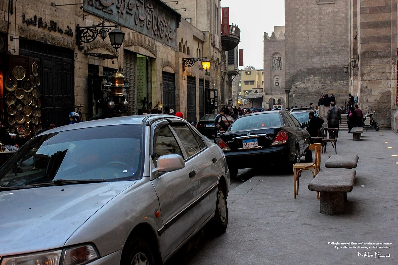
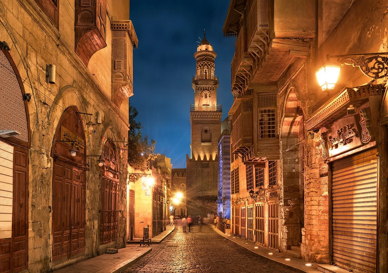
Two genuine views of al-Muizz Street
The article’s first photo is a 2013 original street scene by Nourhan Moubarak, shared under Creative Commons Attribution-ShareAlike 4.0. The second is a different independent 2016 view by M mousa 86, also licensed CC BY-SA 4.0. They depict the living architecture of the same real historic corridor at different times. They are not two crops of the same image, nor are they renderings of how the capital looked in 969.
These two documentary photographs add value when read with the Ministry’s historical description. A modern photograph shows surviving fabric, signage, illumination and use at the moment it was taken. The dates of individual buildings require the appropriate architectural record, not a visual guess. Locally hosted WebP versions can improve site performance while preserving author names and direct Commons file links for lawful attribution.
Why this walk covers nearly a thousand years
The Ministry describes the street’s monuments as spanning from the Fatimid period of the tenth century into the era of Muhammad Ali’s dynasty. That broad span is precisely why a visitor can discover more than one dynasty on a single route. A wall, madrasa, domestic house and commercial building answer different questions about urban society and political authority. The district’s value does not depend on labeling every stone Ottoman or every minaret Fatimid.
For deeper research, use the medieval Egypt period gateway, the Ottoman Egypt gateway and the individual monument dossiers linked above. The purpose of this article is to help a traveller see the sequence of places, choose how to visit them and understand that official ticket rules apply to specific monuments. It is a practical search-intent page informed by historical research, not another undifferentiated list of Cairo attractions.
Official sources and access verification
The route endpoints, dates and identified monuments are grounded in the Egyptian Ministry of Tourism and Antiquities’ al-Muizz Street listing, Cairo Governorate’s historic street guide and the Ministry’s Cairo city walls record. The official street listing distinguishes monument tickets from access to separate properties. Two documentary photographs from 2013 and 2016 are original and independently credited; current times and fees should be checked before any visit.