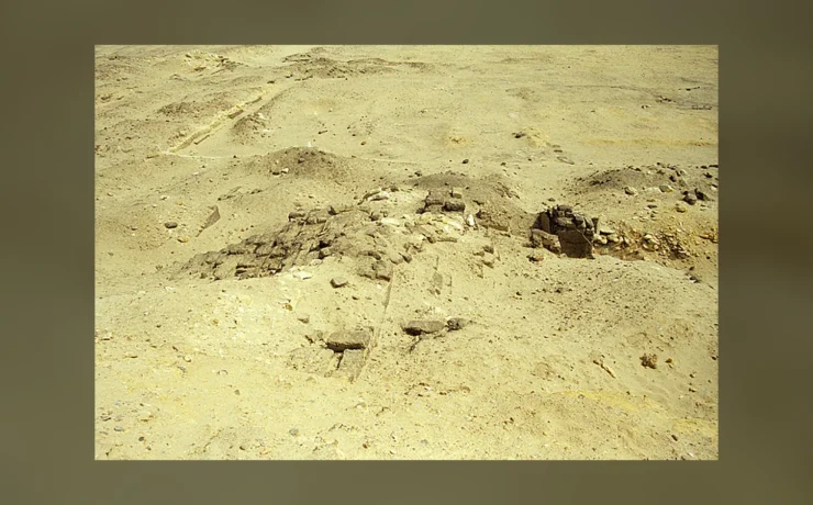
The map usually called the Turin Goldmine Papyrus is one of the oldest surviving attempts to record a real geological landscape. But its popular name hides a remarkable correction: museum scholarship argues that the expedition principally concerned bekhen stone for sculpture, not just gold. Using Barry J. Kemp's questions about state resources and desert knowledge as a starting point, this study follows the actual papyrus, its colored mountains, unusual orientation and later writing on its reverse. A genuine CC0 museum photograph is paired with a licensed documentary photograph of Wadi Hammamat, with their distinct dates and purposes made explicit.
The map was not drawn for curious tourists
A strip of ancient papyrus in Turin shows mountains, roads through dry valleys, and a landscape whose colored rocks seem far more practical than the usual image of Egyptian art. It is often called the Turin Goldmine Papyrus, but that convenient name already risks telling the wrong story. Museo Egizio researcher Andreas Dorn explained in 2024 that the term 'goldmine' distracts from the expedition's main documented purpose: obtaining bekhen stone, a dark greywacke material used for statues. This changes how we read the map.
Barry Kemp's Anatomy of a Civilization raises a broad economic question about how institutions obtained resources from places far beyond the cultivated Nile floodplain. The Turin document supplies direct, unusual evidence of an ancient solution: information about routes, geology and quarrying committed to a portable surface. Its colors and labels were not created for a modern atlas. They served a particular cultural and practical context around 1150 BCE, and much of that context has to be reconstructed from the surviving sheet, inscriptions and archaeology of Wadi Hammamat.
Meet the owner before reading the landscape
The Museo Egizio connects the papyrus with Amennakht, son of Ipuy, a scribe at Deir el-Medina. Scholars consider him a likely author or owner, supported by the handwriting and documentary setting. The fragments entered a European collection in the early nineteenth century through Bernardino Drovetti's acquisitions and are now conserved in Turin. Their cataloguing history means the familiar name of the papyrus is not necessarily the name an ancient scribe used.
Dating is also more precise than 'Pharaonic Egypt' and less exact than a single year. The museum assigns the map approximately to 1156–1150 BCE, within Dynasty Twenty. The image is not a contemporaneous account of the Fourth Dynasty, nor was it drawn for the workers who built Khufu's pyramid. Its writer belonged to a very different administrative and royal world. The original photograph shows ink colors on a fragile ancient sheet. Every interpretation should begin there, not with an attractive modern reproduction whose annotations might silently change how the original lines are perceived.
The Wadi Hammamat corridor in actual geography
Wadi Hammamat cuts through Egypt's Eastern Desert, creating a historic corridor between the Nile Valley and regions toward the Red Sea. The area's terrain includes mountains, dry valleys and quarry resources that attracted expeditions in different periods. To cross this landscape required knowledge of approaches, water, labor and the risks of desert travel. The papyrus represents wadis and bordering hills, but does not behave like a satellite photograph or a full modern road atlas.
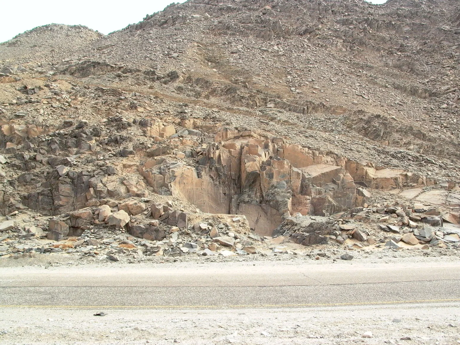
The Museo Egizio records that researchers identify the main wadi with Wadi Hammamat. That identification depends on comparison with the place's geology and history of stone extraction. A modern photograph by Adam Bülow-Jacobsen of the actual wadi shows one piece of the landscape without claiming to show the specific quarry face described in the ancient text. Modern quarrying and road works have changed some terrain, a further reason not to treat today's surface as a perfectly preserved backdrop. The route remains geographically real while the exact expedition pathway needs careful research.

Pink and black: geology translated into color
The map's hills are shown in contrasting hues. Some are pink or marked with brown bands, others black, corresponding to types of rock that ancient travelers could recognize. The Museo Egizio's collection description connects pink forms with sedimentary rock and granite occurrences and black forms with darker rocks, while the specialist interpretation refines their association with particular resource zones. It is therefore important not to turn a single color into a universal rule that every pink hill indicated gold.
A map-maker selected visible distinctions useful for a particular audience. Modern geology uses categories and terminology that do not map exactly onto ancient Egyptian color symbols. Yet the choice to differentiate mountains reveals serious attention to the physical landscape. These are not random decorative touches. Their relative positions and associated inscriptions allow historians to compare the papyrus with mineral and stone sources in the wadi. Reading the colors requires knowledge of both archaeological context and geological conditions, without pretending that an ancient scribe operated with the categories of a twenty-first-century laboratory.
South is at the top: why that matters
Many modern viewers instinctively hold a map with north at the top. The Turin map does not follow that rule. The Museo Egizio says it is oriented toward the south, in the direction of the Nile's source. This is a useful correction because a careless editor could rotate the picture to make it 'normal' and confuse the surviving inscriptions and routes.
Orientation is a cultural convention and a practical choice; it is not proof that Egyptians misunderstood the geography of their country. Ancient maps were made for particular purposes and situations, and their organizing directions did not have to match a modern global standard. The winding wadis are also straightened to fit within the papyrus, which means the reader should not overlay the image onto a current map and expect every bend to align perfectly. Its utility was not measured by the presence of a north arrow. Rather, the combined lines, inscriptions and rock colors conveyed a recognizable route and useful distinctions for someone familiar with the landscape.
A scale that changes as the road bends
The museum reports that the papyrus lacks a constant scale, even if its proportions may occupy a broadly limited range. This matters because distance and direction cannot be reconstructed by measuring centimeters with a ruler and directly translating them into a modern survey. Some stretches are compressed; others occupy more visual space. The scribe straightened major bends of Wadi Hammamat, probably partly to fit the intended information into a manageable sheet.
The absence of a uniform metric scale does not make the map a childish drawing. It reflects the demands of conveying route information on one surface. Modern transit diagrams similarly prioritize relationships and practical navigation over exact relative distances, though the analogy is not evidence about ancient design intentions. In the papyrus, a wadi that connects two places matters as an accessible passage. A hill distinguished by rock type may matter because it tells an expedition where it is or what materials could be obtained. An information-rich map can be highly selective while remaining useful to its intended users.
The quarrying expedition behind the image
An expedition to Wadi Hammamat required more than finding a suitable piece of stone. Workers needed to extract, shape and move heavy material through difficult terrain. Expedition inscriptions and associated evidence illuminate the organization of quarrying under royal authority across different periods. The Turin papyrus belongs to a later New Kingdom moment when the production of prestigious royal sculpture created demand for materials from the desert.
Dorn's 2024 interpretation emphasizes transportation of bekhen stone rather than an expedition primarily devoted to gold mining. That distinction keeps the topic grounded in a documented activity. The map itself does not supply the complete number of workers, their food rations or the mechanical details of every stone-moving operation. A quarry face alone cannot establish who directed its cutting. Archaeologists therefore compare geological traces, dated rock inscriptions, extraction evidence and administrative texts. A royal statue made from greywacke embodies the end product of those processes, while the map suggests how knowledge of the route could be organized before the object reached the Nile.
Why the back of the papyrus is just as important
The verso, or reverse side, was used for several texts, according to Museo Egizio's detailed record. These include letters, religious lists and administrative material not all directly connected with the original route representation. The sheet therefore had a documentary life beyond its front-side map. It may have been repurposed as a convenient writing surface, and traces of different hands or purposes invite detailed palaeographic study.
This is a reminder that maps were material objects, not isolated digital layers. A single papyrus could be rolled, handled, stored, reused and eventually fragmented. The later texts may have survived because they were on the same sheet; their presence does not prove every paragraph concerns one quarrying day. Researchers must identify individual texts and their chronological relationships rather than merging all writing into a fictional expedition diary. Comparing recto and verso allows historians to consider the social life of information, one of the most original aspects of the object. An ancient administrative map was not immune to the mundane practical reuse of expensive writing material.
The named scribe and the other workmen of Deir el-Medina
The likely connection with Amennakht places the map in the literate community of Deir el-Medina, a place of professional scribes and artisans associated with royal tomb construction. This town also produced the famous strike record from the reign of Ramesses III, but the two papyri must not be treated as one document or one event. The goldmine map belongs to a later context associated with Dynasty Twenty, with a separate inventory and subject.
That association nevertheless reveals something important about skilled labor. A person who understood hieratic writing and ritual or administrative texts could also help organize information about desert resources. Ancient expertise did not divide neatly into modern academic specialties. Yet we should not assign every aspect of the map's design to the same person with absolute certainty or imagine that all tomb-workers were capable surveyors. The historian's task is to consider what the collection records actually support: a probable scribe, an original map, associated reuse and a plausible historical setting in which quarry logistics mattered.
A first geological map, but what does 'first' mean?
The Turin papyrus is regularly called one of the world's oldest surviving geological or geographic maps. Such a label concerns the earliest known extant evidence of a certain type; it cannot prove that earlier people elsewhere never created route diagrams or distinguished rock. An archaeological superlative depends on what has survived and how specialists define the category.
The map is unusual because it combines a recognizably terrestrial route with differentiated rock types and annotations. It represents genuine knowledge rather than abstract symbols alone. But it should not be presented as a complete geological survey in the modern academic sense, with standardized lithological keys, coordinates and reproducible measurements. Its significance lies in specificity. For a particular stretch of the Eastern Desert, the creator organized features that were relevant to movement and material extraction. A well-grounded encyclopedia can explain why this deserves the word geological while also describing the ways the document differs from a modern geological sheet. That gives students a better introduction than simply celebrating another world-record headline.
The photographed map and the photographed landscape
The first documentary image is the actual Goldmine Papyrus from the Museo Egizio's open collection, made available under CC0. It is a very wide fragmentary manuscript, so the article keeps its aspect ratio rather than stretching the map into a fake picturesque panel. The second image is an authentic licensed modern photograph of Wadi Hammamat by Adam Bülow-Jacobsen, showing a quarry landscape in the area with which the ancient map is associated.
These two photographs do not make the impossible claim that a camera recorded a Twentieth Dynasty expedition. The ancient object documents the production of geographic information; the present-day photo locates the subject in a surviving place. Neither alone settles the exact path of the depicted ancient mission. To understand the terrain fully, a reader should consult the museum's textual descriptions and archaeological research on quarrying in the corridor. The paired images encourage visual comparison without fabricating a hyper-realistic ancient mining scene whose details could never be verified.
The map as an economic document
An empire's dependence on resources was expressed through much more than written tax orders. Surveying, knowledge of stone sources, practical route selection and communication among specialists all contributed to making distant materials available for major monuments. Kemp's discussion of the Egyptian economy invites us to look for those practical connections rather than treating mined stone as an automatic gift from the desert.
The Turin map offers a case in which information itself was part of the production process. A stone cannot be transported from an unknown quarry; an expedition cannot work effectively without some knowledge of approaches and supply needs. How the particular map circulated among officials is not recorded, and the association with a royal mission remains an interpretation of context and content. Nevertheless, its combination of road, wadi and geology illustrates why information could have economic value. It is a material trace of expertise within a state that required stone, labor and organized travel. By following this evidence carefully, the map becomes more informative than a generalized statement that pharaohs exploited mines.
The best reason to preserve its uncertainties
The map does not tell us who first discovered the Wadi Hammamat deposits, how many people participated in every mission, or whether the sheet was routinely taken into the field. It has survived through a complicated archaeological and collecting history; modern cataloguing combines fragments and identifies several different texts. These limits do not weaken the object as a source. They help define its significance.
A student can verify the museum accession group, inspect the actual colored ink, compare the reported Wadi Hammamat identification and read the specialist argument about bekhen stone. That process demonstrates historical research rather than merely consuming an exciting story. The papyrus was not produced to satisfy twenty-first-century curiosity about 'the first map'. It belonged to the practical and intellectual world of Egyptian scribes and quarry expeditions. Read alongside Kemp's larger concerns about economic institutions, it gives a wonderfully specific answer: one way a distant landscape became part of the working knowledge of the state was to put the desert onto papyrus.
Evidence at a glance
| Evidence | What can be concluded |
|---|---|
| Museo Egizio map | Original Twentieth Dynasty papyrus depicting Wadi Hammamat, with differentiated rock colors. |
| Andreas Dorn, 2024 | Scholarly correction that the map's better-attested expedition concern was transport of bekhen stone. |
| Orientation | South toward the Nile's source is at the top, not modern north. |
| Scale | The bends of the wadi are schematized; the map is not a constant-scale modern survey. |
| Verso texts | Later or separate written uses of the sheet, not one continuous narrative about gold. |
Frequently asked questions
Is the Turin Goldmine Papyrus a real ancient map?
Yes, Museo Egizio conserves the original fragmentary papyrus with a recognizable map of the Wadi Hammamat landscape.
Does the map simply show gold mines?
Its nickname is misleading. Museo Egizio scholarship emphasizes an expedition to transport bekhen stone, dark greywacke used for sculpture.
Why is south at the top?
The papyrus is oriented differently from modern convention, toward the source of the Nile.
Can visitors see an original photograph?
Yes. The article uses a CC0 image of the genuine museum papyrus, alongside a separate real photograph of Wadi Hammamat.
Sources and image provenance
This article uses the historical source listed in the bibliography as a research starting point, specifically PDF pages Barry J. Kemp, Anatomy of a Civilization, supplied scanned Arabic edition, discussion of Egyptian production, landscape and long-distance state resource acquisition; the specific 1150 BCE map is independently sourced from Museo Egizio.. Its historical rhetoric and older interpretations are not treated as conclusive archaeological evidence. The external museum and research records below are linked for independent checking.
- Museo Egizio original Goldmine Papyrus catalogue and rock color explanation
- Museo Egizio papyrus specialist collection study, Turin Mine Map
- Museo Egizio 2024 scholarly lecture by Andreas Dorn: bekhen stone rather than only gold
- CC0 original Goldmine Papyrus object photo in Wikimedia Commons
- Documentary photograph of Wadi Hammamat location, CC BY 4.0
- Wadi Hammamat historical quarrying and landscape studies
- Barry J. Kemp, original book edition supplying the economic-history framework
- Photograph: Actual CC0 photograph of the Turin Goldmine Papyrus, Museo Egizio Cat.1879/1969/1899, ca. 1156–1150 BCE. An original map of Wadi Hammamat, not a modern reconstruction., Museo Egizio Turin, open-access original papyrus Cat.1879/1969/1899, CC0, CC0
- Photograph: Real modern research photograph of Wadi Hammamat by Adam Bülow-Jacobsen (CC BY 4.0); the present terrain, NOT a Twentieth Dynasty expedition scene., Adam Bülow-Jacobsen, field photograph of Wadi Hammamat published CC BY 4.0, CC BY 4.0