Karnak did not always stand on the dry ground visitors walk across today. A 2025 geoarchaeological study traced older Nile channels around a raised tract of land where the temple complex eventually developed, using 61 sediment cores and ceramic evidence. Another excavated sequence beneath the Temple of Ptah revealed earlier mudbrick, hearths and river deposits. This long-form investigation takes Barry J. Kemp's interest in the Nile, sacred ideas and early state formation as its intellectual starting point, but checks every modern archaeological claim against the specialists who performed the research. Two accurately dated photographs show the surviving Karnak complex, not imaginary pictures of an ancient island.
The sanctuary whose first architect may have been a river
The Great Temple of Amun at Karnak invites one kind of question: which pharaoh added this hall, gate or obelisk? Archaeology now demands an earlier question. What ground stood there before any great columns could rise? A major geoarchaeological study published in 2025 reconstructed an earlier Nile landscape in which channels ran around a raised terrace or island-like tract. The site on which the later temple developed was not always the dry, stable land familiar to modern visitors.
Barry J. Kemp's Anatomy of a Civilization emphasizes that Egyptian sacred ideas and institutions cannot be detached from the Nile and the physical organization of settlement. His work offers our starting question, but the precise core samples, dates and island model come from twenty-first-century research. The result is a rare story in which the landscape shapes our understanding of architecture. At Karnak, a temple was built not upon an abstract flat page, but upon land created and transformed by a living river. How those changes affected early occupation is now a matter of field evidence rather than a picturesque origin myth.
A famous temple and an earlier invisible terrain
Karnak is the sprawling sacred complex on the east bank of the Nile near Luxor. Later New Kingdom kings expanded the precinct of Amun-Ra through monumental halls, pylons and other works over many centuries. Most of these standing features are much younger than the earliest known occupation of the site. That difference between what tourists see and what archaeologists excavate is fundamental.
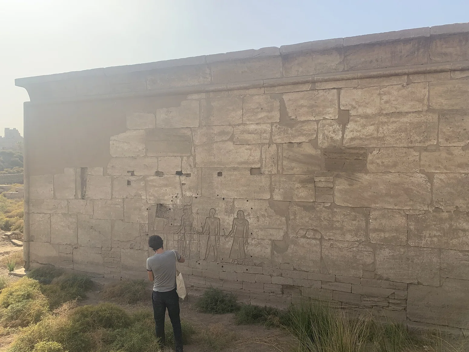
A photograph of the Temple of Ptah, for example, depicts later architecture. Its walls and columns are genuine ancient fabric but not an untouched sanctuary from 2200 BCE. The present temple was developed under New Kingdom and later rulers, over ground with earlier occupations. Similarly, an overview of Karnak's great complex identifies the landscape of temples as it survived into the modern era, not a photographic record of an early island. Dating an excavated charcoal layer beneath a later building is therefore not the same as dating the building itself. The first job of this article is to keep those time layers separate.
Sixty-one cores beneath the familiar ruins
The 2025 research team assembled 61 sediment cores from within and around Karnak, alongside analysis of large ceramic assemblages. A core is a narrow column of deposits extracted from the ground; its strata can help identify former river channels, flood surfaces and conditions suitable for occupation. Such a sample has to be interpreted spatially and alongside other cores. One narrow hole cannot reveal the original course of the entire Nile on its own.
The researchers concluded that the area had been affected by active floodwater before land formation made settlement feasible. Their paper describes Karnak on a fluvial terrace segment with channels creating an island configuration. This is not a fantasy island surrounded by permanent deep water at every hour of every century. River channels could migrate, partially fill and change during floods. The analytical achievement lies in mapping those changes from deposits and chronology, not in giving the visitor a cinematic recreation. The separate 2021 study by Charloux and colleagues had already identified how retreating river margins related to early human occupation. The new research broadens that field of view.
What 2520 BCE ±420 years actually means
The 2025 study argues that permanent occupation of central Karnak became possible after a change in river deposits dated around 2520 BCE with substantial chronological uncertainty. The ±420-year range matters. It is not a known anniversary when somebody stood on an island and declared a sacred foundation. The Uppsala University research statement explicitly warns that before that broad interval the area would have been vulnerable to fast-flowing floodwater.
The earliest ceramic material discussed in the project suggests activity extending into the later Old Kingdom or First Intermediate Period, but finds made in an active river environment can be displaced. A fragment carried by water may be older than the deposit where it came to rest. An archaeological date is only as good as its context. Later temple construction can complicate the original layers even further. For readers accustomed to a list of confident dynastic dates, the lesson is valuable: an uncertainty band is honest measurement, not evidence of careless scholarship. The earliest occupation of Karnak is a research problem still being refined.
A sanctuary on the kind of ground creation myths remembered
Ancient Egyptian religious thought sometimes imagined creation beginning with land rising from primeval waters. The authors of the 2025 study suggest that the island-like configuration of Karnak may have resonated with the concept of the primeval mound. This is a fascinating possibility, not a documented diary of the first worshippers' choices. There is no recovered inscription saying that Karnak's founders selected the site because a particular flood channel reminded them of creation.
The distinction between resemblance and motivation is crucial. A river could create habitable raised ground for practical reasons; later people might attach sacred meaning to its shape. Or both processes might interact without leaving a written explanation. Kemp's broader work on religion and state ideology helps explain why landscapes could become meaningful, while the field research sets limits on what can be inferred about this particular place. A reader should not have to choose between geology and belief as if one cancels the other. The research invites comparison while preserving uncertainty about ancient intention.
The first deep trench at the Temple of Ptah
The 2021 study published in Antiquity examined deep levels beneath the Temple of Ptah area and provided one of Karnak's first securely contextualized sequences for its earliest occupation. Archaeologists found river deposits, a small domestic hearth, mudbrick remains and successive building phases. They dated the material through pottery study and radiocarbon analysis. Those two methods answer related but not identical questions.
The hearth is especially striking because it belongs to everyday activity rather than monumental worship. It suggests that people used the riverbank before the later sanctuary dominated the location. The team's interpretation places early occupation in the broader Eleventh Dynasty sequence, while some older materials appear to have been moved from elsewhere by the river. A clay cooking installation found beneath a later religious monument does not prove that the first activity in that exact spot was a temple ritual. It may document domestic life in a growing town. That is part of the article's originality: we look for the everyday ground under a sacred landmark, not only the foundation stones of famous kings.
Two old bowl fragments can mislead if you let them
Among the deposits identified in the 2021 excavations were worn sherds characteristic of the late Old Kingdom. Those fragments are important because they hint at earlier activity in the wider region. Yet the researchers explain that they were found in deposits affected by river movement and may have originated from a settlement to the south-east. Without that qualification, it would be tempting to write: 'A Fourth Dynasty village existed beneath the Temple of Ptah.' The paper does not prove that conclusion.
Archaeologists use the condition of pottery, depositional context and dates of associated material to distinguish primary occupation from redeposited objects. A sherd may have been manufactured in one period, used somewhere else, and carried by water before being buried. A photograph of an ancient bowl does not fix that chain of events. This case illustrates why careful reconstruction can make a site more interesting than a sensational discovery headline. It asks whether a layer tells us where people lived or merely where an old object eventually came to rest.
Seven building phases, no instantaneous city
The 2021 excavators identified a sequence of domestic mudbrick structures with seven successive architectural phases in one investigated level, which they thought represented a period spanning at least a century. Such layering shows a settlement developing, changing and rebuilding rather than appearing in one completed master plan. The precise interval of each phase is difficult to calculate, partly because radiocarbon ranges overlap. Pottery comparisons help refine the broad sequence.
This is a very different picture from the later formal temple axes and stone processional routes. In an early community, structures could be replaced while river margins altered the usable ground. The city that developed around Karnak was not simply an empty expanse awaiting a pharaoh's blueprint. Its history included occupation, flood deposits, repairs and shifting relations with the water. The 2025 study's wider cores and the 2021 trench should be read as complementary, not as identical investigations repeated in different words. One maps broad environmental change; the other provides a detailed local sequence of human activity.
The Theban kings and the emerging religious center
The Eleventh Dynasty rulers rose to power from Thebes during the reunification of Egypt after the First Intermediate Period. The 2021 paper connects the development of Karnak and westward expansion of its settlement with the growing political strength of the region. It discusses an early sanctuary traditionally associated with Intef II and later development under rulers such as Mentuhotep II and Senwosret I. These connections belong to a broader interpretive chronology, not a complete preserved building contract.
An expanding city and an important sanctuary could reinforce each other. The royal court and religious institutions attracted people, resources and construction; settled ground and river access made that growth possible. The Nile was therefore not merely a picturesque backdrop to Theban politics. It shaped what land could be occupied, where people might build and how a sacred precinct related to a town. Kemp's model of statehood is useful because it lets these forces interact without reducing everything to one powerful ruler's personal taste. Geography and authority developed together, sometimes opportunistically and sometimes through planning.
Could archaeologists finally date Karnak's foundation?
The answer depends on what the question means. The earliest activity at the landscape, the earliest permanent settlement, the first sanctuary, the first written mention of a deity at the site and the surviving stones of later temples may all have different dates. A research report on sediment cores cannot give a definitive regnal year for a lost wooden shrine. A passage identifying a temple in royal titulary may not establish the precise location or construction material of the building.
The 2025 project advances the environmental limits on occupation and suggests a likely Old Kingdom beginning, while the 2021 work emphasizes securely excavated Eleventh Dynasty occupation under the Ptah temple area. These are not necessarily a contradiction. The datasets ask different questions and carry different strengths. Archaeologists may discover earlier contexts in future seasons that refine the chronology again. Until then, the best formulation is that the monumental New Kingdom Karnak stands over a considerably older settlement and sacred history whose landscape has become better understood through stratigraphy, pottery and geoarchaeology.
The photographs tell the truth about what survives
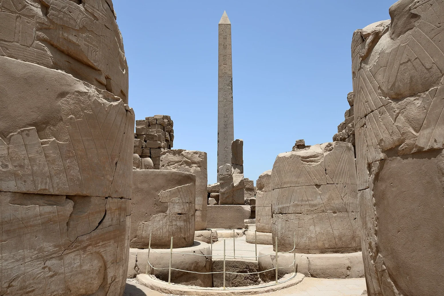
The first image accompanying this essay shows the Temple of Ptah within Karnak, photographed in 2024 by Marsupium. The second is an authentic 2015 photograph of the wider Karnak temple complex by Hamerani. They are valuable views of the extant archaeology, but neither is an archaeological core section and neither depicts Karnak's hypothesized earliest island as it looked in the third millennium BCE.
The visual distinction is important. A photograph of current sandstone columns cannot serve as evidence for a date established from buried charcoal. Readers must follow the published research figures and methods for that. The pictures help locate the problem in the landscape they could visit today, while the site formation is explained by the specialists who analyzed it. Both photographers supplied Creative Commons licenses, which allow the images to be reused with attribution and an appropriate account of editorial modification. Rather than fabricate a photorealistic river island and label it ancient history, the article preserves the actual date and origin of each image.
What might still be concealed beneath Karnak
Large temples are difficult archaeological sites to excavate comprehensively. Their standing structures must be protected, older levels lie deep beneath later floors, and excavation windows are often narrow. River deposits add another challenge because they can carry material from upstream or obscure older activity. The 2021 paper explicitly describes how previous excavations often lacked the stratigraphic information needed to settle the earliest chronology. The 2025 project attempts a more systematic reconstruction using cores across the area.
Future work could clarify the extent of early settlement, relationships between separate mounds and channels, and the earliest sacred structures. But not every question requires an imagined lost chamber or spectacular treasure. Sometimes the important discovery is an altered boundary between water and land. The task for an encyclopedia is to present the research process rather than promise that one dig will reveal an exact moment when Karnak was born. That makes the site more accessible to students: chronology comes from testing competing kinds of evidence, not from a dramatic caption attached to a temple photograph.
The civilization underneath the columns
Karnak's grand columns present ancient Egypt at its most monumental; its earliest layers reveal people navigating a changing river edge. In the field, both are parts of the same historical problem. Stable land made occupation possible, settlers and rulers gave it institutions, and religious forms accumulated until the site became one of the world's most extensive temple complexes. The process did not unfold in a single century and cannot be read as the inevitable triumph of a fixed plan.
Barry Kemp's insistence on considering landscape, belief and the state together remains a useful intellectual framework. The 2021 and 2025 research allows that framework to be tested with hearths, pottery, sediment and dated cores. The result is not 'Kemp predicted a Nile island' or 'a new paper proves creation myths literal.' Neither statement follows. The result is an original account of an ancient place whose natural and sacred history cannot be separated, while the evidence for each is kept distinct. At Karnak, the best starting point may no longer be a pharaoh's name above a gate, but the earth beneath it.
Evidence at a glance
| Evidence | What can be concluded |
|---|---|
| 2025 Karnak geoarchaeology | 61 sediment cores and ceramic analysis reconstruct an older island-like river terrace; occupation dates carry uncertainty. |
| 2520 BCE ±420 years | Estimated broad threshold after which occupation became possible, not an exact temple foundation date. |
| 2021 Temple of Ptah trench | Hearth, flood deposits, pottery and successive mudbrick building phases from early Karnak occupation. |
| The primeval mound comparison | An interpretive possibility, not direct proof that ancient founders selected the site for one named myth. |
| 2015 and 2024 site photographs | Genuine surviving architecture, explicitly separated from the earlier buried landscape reconstructed by research. |
Frequently asked questions
Was Karnak literally an island?
The 2025 study reconstructed a raised fluvial terrace with Nile channels around it, in an island-like configuration. Water conditions and channels changed through time.
Was the temple founded exactly in 2520 BCE?
No. That is an uncertain date associated with when permanent occupation became environmentally feasible, not a recorded founding year for the temple.
Are the present Temple of Ptah walls the earliest sanctuary?
No. The visible building is substantially later; excavations beneath its area uncovered earlier deposits and settlement evidence.
Did the Nile island represent the primeval mound?
Researchers suggest a possible relationship with Egyptian creation imagery, but the original motivations of the site founders are not directly documented.
Sources and image provenance
This article uses the historical source listed in the bibliography as a research starting point, specifically PDF pages Barry J. Kemp, Anatomy of a Civilization, supplied Arabic edition, opening discussion of Nile landscape and political institutions (PDF pp. 21–45), and sacred architectural spaces (PDF pp. 309–315); the 2021/2025 island discoveries are independent modern research.. Its historical rhetoric and older interpretations are not treated as conclusive archaeological evidence. The external museum and research records below are linked for independent checking.
- 2025 Antiquity study: Conceptual origins and geomorphic evolution of the temple of Amun-Ra at Karnak
- 2025 Uppsala University study release: Origins of Ancient Egypt's Karnak Temple Revealed
- 2021 Antiquity study: The shifting Nile and origins of ancient Karnak
- British Museum research repository: 2025 Karnak geoarchaeological study with CC BY 4.0 data
- Wikimedia Commons: verified 2024 image of Ptah Temple at Karnak
- Wikimedia Commons: original 2015 Karnak temple complex photograph
- Egyptian Ministry of Tourism and Antiquities: Karnak Temple archaeological visitor information
- Photograph: Authentic 2024 view of the Temple of Ptah at Karnak by Marsupium, CC BY 4.0. The photographed architecture is much later than the excavated earliest settlement layers., Marsupium, authentic 10 March 2024 photograph of the Temple of Ptah in the later Karnak complex, CC BY 4.0
- Photograph: Original 2015 archaeological photograph of Karnak temple complex by Hamerani, CC BY-SA 4.0. This is the standing complex, not a photograph of the reconstructed ancient Nile island., Hamerani, actual Karnak site photograph, 25 May 2015, CC BY-SA 4.0