What is special about the Pyramid of Senusret II at El Lahun? This Twelfth Dynasty royal pyramid stands near the Fayum, built largely with a mudbrick superstructure over elevated limestone bedrock and originally faced with white limestone. Its burial access through a shaft on the south-eastern side differs from a common north-side arrangement in many earlier royal pyramids.
This study focuses specifically on the pyramid’s materials, entrance, burial complex, excavation record and recent geophysical research. The nearby Lahun planned town has its own separate article, avoiding a repeat of the same archaeological subject under two search keywords.
Why Senusret II chose Lahun
The pyramid of Senusret II stands at El Lahun near the entrance to the Fayum in Middle Egypt. Its location is different from the better-known northern royal pyramid fields at Dahshur and Giza. UCL’s Digital Egypt project connects the monument with the Twelfth Dynasty king Khakheperre Senusret II and places it within a landscape that included temples, cemeteries and a large planned settlement. Choosing this location created a new relationship between royal burial, the Fayum region and the cultivated Nile Valley.
Modern descriptions sometimes label the site simply Kahun, a name that was also used for the nearby town in older excavation literature. UCL explains why El Lahun is a clearer designation for the pyramid and its surrounding site. It is important to separate the king’s actual funerary monument from the urban settlement, because they preserve different evidence. This article focuses on the pyramid’s construction, burial access, remains and archaeology, while Kemet Vault’s existing study of the Lahun town covers its streets, houses and administrative papyri.
The Twelfth Dynasty king and the Middle Kingdom context
Senusret II was a ruler of the Twelfth Dynasty. UCL’s chronology identifies him by the throne name Khakheperre and records the pyramid at Lahun as his burial place. The monument belongs to the Middle Kingdom, a period in which kings used pyramid forms but often adopted building methods that differed from the large Old Kingdom stone pyramids. The surrounding Fayum landscape was becoming important in economic and royal activity, giving this burial complex a distinctive geographical context.
A royal pyramid should not be evaluated only by its surviving height. The building was part of a larger funerary system with ceremonial, religious and administrative roles, and the choice of site expressed the king’s connection with a particular region. The exact motivations behind a royal decision are not always recorded in surviving documents. Archaeologists can describe the physical location and compare it with other royal projects without inventing a diary that explains the ruler’s thoughts.
Mudbrick and limestone: how the pyramid was built
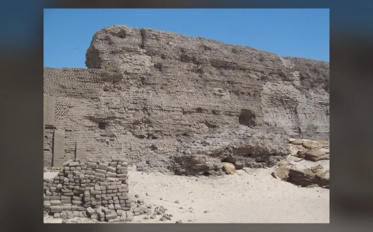
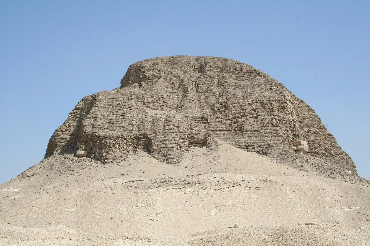
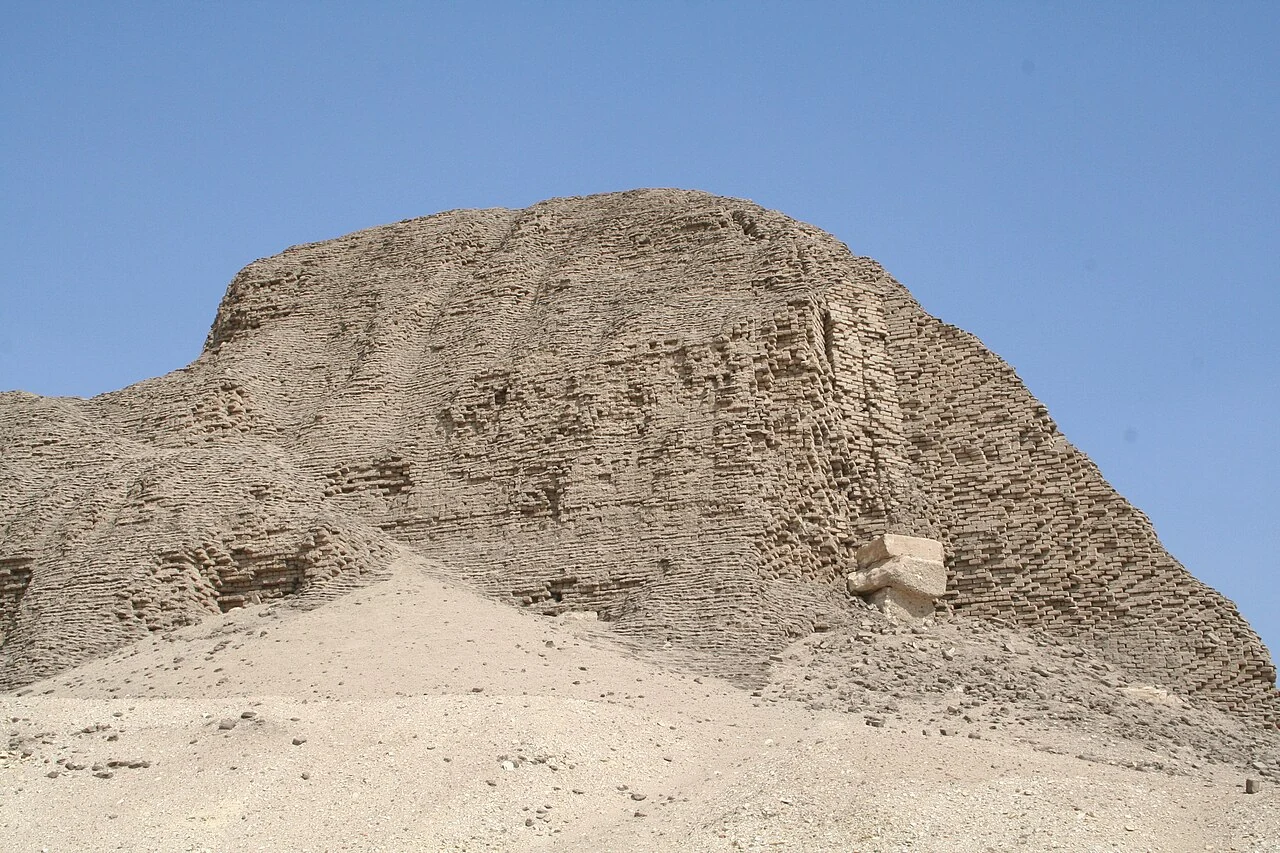
One of the most revealing aspects of the Lahun Pyramid is its construction. A study published in Pure and Applied Geophysics explains that the monument was built largely from mudbricks over a natural elevated limestone bedrock core and was originally encased in white limestone. The ancient structure therefore looked different in its completed form from the eroded mass visible today. The weathered surface does not mean that the original royal pyramid was designed as an irregular mound.
Manchester Museum’s Egyptology research describes a structural framework involving limestone walls and sun-dried mudbrick infill. A trench cut into the rock supported the casing’s lowest course and helped reduce movement. These features demonstrate practical attention to the interaction between materials. Builders could use locally available brick for large volumes while reserving dressed stone for selected structural and visible components. This is not evidence that ancient Egyptian workers used modern reinforced concrete or that a later erosion pattern was deliberately built into the exterior.
Why the rock outcrop mattered
The pyramid was located on an elevated formation of natural limestone rather than entirely on a level field. Geological and topographical features shaped where the core could stand and how surrounding ceremonial routes were planned. The natural base reduced some of the material needed for the monument but required a building scheme adapted to the site. Modern studies use the terrain to explain relationships between the pyramid, the valley temple and the large settlement to the east.
An archaeological interpretation should avoid turning that terrain into a claim about mysterious underground energies. A rock outcrop is a practical feature that engineers can examine and map. The site also illustrates why physical geography matters to royal planning. The Hawara Pyramid study covers a different Fayum royal monument, providing a useful comparison of later Twelfth Dynasty funerary construction without merging the two complexes.
Where is the entrance to the burial chamber?
An important difference at Lahun is the position of access to the royal burial spaces. The 2022 geophysical study identifies the known entrance through a vertical shaft to the south-east of the pyramid’s southern side, a significant departure from the more familiar north-side entrance arrangement. Nineteenth-century excavations documented passages and associated shafts. The design makes the site especially useful for comparing changing strategies of protecting royal burial chambers.
It would be too confident to assert that the unusual entrance permanently defeated ancient robbers, because the actual burial context and later disturbance need independent evidence. Nor should modern diagrams be mistaken for photographs of every hidden internal passage. The distinctive southern access is established in archaeological accounts, but reasons for the layout can involve more than one proposed interpretation. The structural evidence deserves to be explained before a single motive is presented as certain.
The actual photographs of the pyramid
The two documentary photographs in this article were made at El Lahun by a photographer credited on Wikimedia Commons as Einsamer Schütze in September 2006. They show the real surviving pyramid from different frames and have separate source records. Both were offered under Creative Commons Attribution-ShareAlike 3.0 among other compatible terms. The images help readers understand the eroded mudbrick mass and its place within the landscape.
Their age is disclosed in the captions. These are photographs from 2006, not a guarantee that site access, conservation work or the exact foreground will look identical in 2026. The photographs also cannot reveal the original white casing in its complete ancient condition. A viewer should combine what the current exterior demonstrates with the archaeological records that identify construction materials and the buried structures. Using two real images avoids creating a digitally polished fantasy pyramid unrelated to this site.
The pyramid complex beyond the central mound
A royal pyramid was more than its central body. UCL describes the wider Lahun complex through evidence of religious buildings, finds from the mortuary temple and features related to the valley temple. Such structures supported the ceremonial and commemorative functions of the king’s cult after death. Archaeologists also examine enclosure boundaries, processional routes and associated burial places when reconstructing how the complex operated. Much of this architecture is less visible now than the central pyramid.
It would be misleading to redraw a complete ceremonial plan without showing which features are excavated, inferred or lost. A causeway alignment may be suggested by surviving foundations and topography, while material recovered from a temple can provide evidence of decoration or ritual. Each kind of evidence has its limits. The archaeological challenge is to combine dispersed observations without claiming that every wall survives at full height.
The Lahun pyramid town is a separate research question
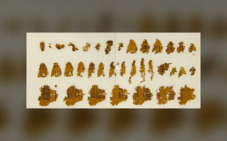
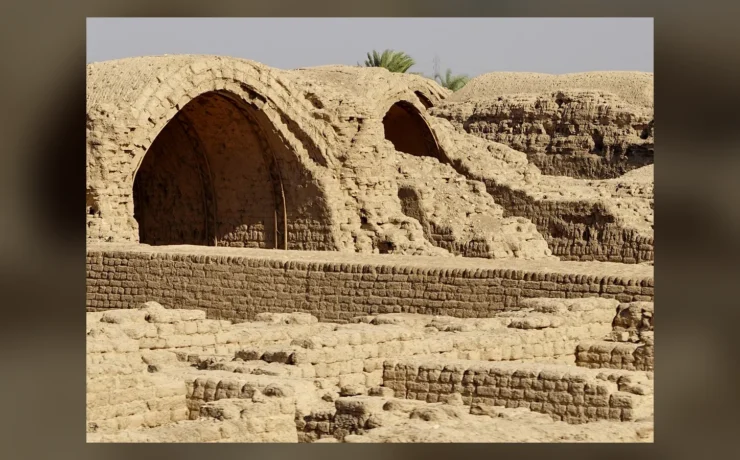
The planned town near Lahun, often called Kahun in older publications, is among the most informative ancient Egyptian settlements studied by archaeologists. UCL describes its buildings, everyday objects and papyri, including records associated with the cult of Senusret II. Yet the relationship between the town and the physical workforce that constructed the pyramid cannot be assumed to be simple. Some scholarly treatments note that the settlement was distant enough from the building site to raise questions about where construction workers actually lived.
This distinction is the reason for giving the pyramid and town separate articles. The town’s documented streets and houses illuminate Middle Kingdom administration and domestic life. The pyramid’s rock core, brick masonry and unusual entrance illuminate royal funerary engineering. Readers seeking papyri and housing should visit the already published Lahun town research rather than encounter a rewritten copy of it here. Both can be connected through verified internal links.
Royal family burials and associated cemeteries
The wider funerary landscape around the pyramid included burials of high-status members of the royal circle and other cemetery features. Excavation accounts associate the area with a burial belonging to Princess Sit-Hathor-Iunet, famous for jewelry and related finds. The historical collection context and precise tomb identification matter because artifacts removed from their excavation setting may now be displayed in museums. Their present museum location is not the same as their original burial position.
A royal family’s burial objects can illustrate elite material culture, but a dramatic gold ornament does not prove that all people living in the Lahun town enjoyed the same wealth. Social differences must be read across multiple sources. The site combines royal, administrative and domestic evidence, allowing questions about the distance between elite display and everyday life. The excavation history also reminds us how much information can be lost if objects are presented without their original stratigraphic and documentary context.
Flinders Petrie and the excavations
The late nineteenth-century excavation history of Lahun is strongly associated with Flinders Petrie and collaborators. UCL lists investigations in 1889, 1914 and 1920–1921, while the published Treasure of Lahun account records a campaign concerned with the pyramid complex and associated royal burials. The detailed historical dates tell researchers which records may refer to a particular phase of the work. They also show that excavation was not a single moment in which the whole site was discovered at once.
Earlier excavators sometimes worked without all the recording standards expected today. Finds can be well known yet lack a secure context detailed enough to answer a modern question about original placement. This does not make the material valueless; it requires careful source criticism. Modern archaeological work can revisit existing plans, photographs and objects with improved techniques while acknowledging the limits of nineteenth-century recovery and interpretation.
What modern geophysics adds
A peer-reviewed geophysical survey published in Pure and Applied Geophysics used magnetic and gravity methods to investigate selected areas around the Lahun complex. Researchers reported anomalies that could relate to pits, chambers, structural remains and other archaeological features. The important word is could: a geophysical anomaly is evidence of a physical contrast, not an automatically confirmed palace, burial or temple. Further testing and careful interpretation are needed to identify its cause.
The study demonstrates that a long-investigated archaeological site can still produce useful new evidence without sensational claims of impossible hidden cities. Measurements can help guide excavation decisions and protect areas from unnecessary disturbance. At the same time, the survey does not replace the older plans and excavation records; it adds another source type. An evidence-based article presents both the promise and the limitations of modern methods rather than turning each unexplained signal into a guaranteed discovery.
Why the missing white casing matters
The surviving pyramid looks markedly different from the smooth-sided white limestone monument it was intended to present. Once the fine casing was removed or damaged, the underlying brick-based construction became more visible and vulnerable to weathering. The change in appearance can mislead a casual observer into thinking that Middle Kingdom pyramids were always meant to look like heaps of earth. In fact, the materials and design indicate a carefully finished royal structure.
Casing loss also affects conservation. Mudbrick reacts differently from limestone to water, salts, erosion and wind. Protecting a monument with exposed earth-based masonry is not the same practical challenge as caring for a largely intact stone wall. A modern photograph documents the state visible at one time; archaeologists must use physical remains and records to reconstruct what was originally built, leaving uncertainty where the evidence is incomplete.
The archaeological value of the Fayum setting
Lahun’s position near the Fayum is valuable for understanding why Middle Kingdom rulers invested in particular landscapes and their relationship to agriculture, water and movement. The site links a pyramid complex to nearby habitation and administrative records, creating a richer historical picture than a freestanding monumental photograph alone. The region’s topography and geology shaped both the choice of building location and the paths connecting the parts of the complex.
The monument belongs to a sequence of Egyptian royal projects but retains its own character. The Bent Pyramid at Dahshur illustrates much earlier Fourth Dynasty stone engineering, while Lahun demonstrates Middle Kingdom use of a natural rock base and substantial mudbrick construction. Neither should be described simply as a failed attempt to imitate Giza. They reflect different periods, materials, religious landscapes and practical building decisions.
Visiting the monument without inventing access conditions
El Lahun is a real archaeological site near the Fayum, not an open-air theme-park reconstruction. The public status of internal access, preservation zones, guiding and transport arrangements can change. The existence of a documented shaft or burial chamber does not mean that visitors are entitled to enter it on any particular day. Tickets, site opening conditions and safety restrictions should be checked with Egypt’s official heritage authorities before planning travel.
Responsible visitors should avoid climbing fragile exposed masonry, entering closed spaces or treating archaeological debris as souvenirs. Documentary photographs are best taken from permitted areas. An independently researched cultural visit can connect the monument with the surrounding Fayum landscape and the nearby Lahun town, but should allow adequate time for travel and acknowledge current conservation needs. Historical accuracy and respect for a vulnerable site are part of the same experience.
Primary archaeology, museum and survey references
The attribution, settlement contrast and royal context are grounded in UCL Digital Egypt’s Lahun survey, its Senusret II pyramid dossier and planned town and finds study. Construction materials are described in Manchester Museum’s Egyptology research and the 2022 peer-reviewed geophysical survey. Historic excavation evidence appears in The Treasure of Lahun. Both photographs are real site views from 2006, not digital reconstructions.