What is the Hawara Labyrinth, and is it still standing? The Labyrinth is the name used by Greek authors for the extensive mortuary temple associated with Amenemhat III’s Middle Kingdom pyramid at Hawara in Fayum. The temple is now badly ruined. Its actual footprint and archaeological finds must be distinguished from elaborate ancient descriptions and unverified modern claims about hidden chambers.
On the eastern edge of the Fayum, the eroded mound of the Hawara Pyramid hides a story that is far more complex than a vanished wonder. Amenemhat III constructed this Middle Kingdom pyramid with a mudbrick core, limestone casing and an unusually difficult burial approach. An adjacent mortuary complex became known to Greek writers as the Egyptian Labyrinth. Their enthusiastic descriptions survive, but the architecture has suffered quarrying, erosion and groundwater damage. This article brings those different kinds of evidence together, using the Egyptian Ministry of Tourism and Antiquities, UCL Digital Egypt, the Egyptian Museum in Cairo and academic archaeology. It separates authentic excavation evidence from spectacular modern reconstructions, and does not treat the word ‘Labyrinth’ as proof that a huge hidden underground city has been discovered.
For a distinct Middle Kingdom evidence type, explore Middle Kingdom architectural models from Meketre’s tomb. The later historical phase at Hawara belongs with the later Roman-era Fayum burial portraits, not the original pyramid construction.
Where is Hawara in the ancient Fayum landscape?
Hawara lies near the entrance to the Fayum depression, south of modern Cairo and southeast of the city of Fayum. Its position connected a royal burial project with a region of agriculture, waterways and settlements. The Fayum landscape changed through irrigation, lake-level variation and habitation over many centuries, so the surroundings visible in a modern photograph differ from those in Amenemhat III’s reign. Archaeologists therefore study the pyramid in relation to its terrain and the wider Middle Kingdom investment in Fayum.
UCL Digital Egypt describes Hawara as a place with a Middle Kingdom pyramid and temple complex, and a cemetery used into the Roman period. Those later burials make the site more than one king’s building project. A map of Hawara should distinguish the pyramid, the ruined temple and the later cemetery rather than combining them into a single ‘secret city’. The site’s value comes partly from the connections between those layers of Egyptian history.
Who was Amenemhat III of the Twelfth Dynasty?
Amenemhat III was a king of the Twelfth Dynasty during Egypt’s Middle Kingdom. UCL identifies him with building projects around Fayum and with a pyramid at Hawara, as well as an earlier pyramid project at Dahshur. Royal investment in the region has attracted attention because of its associations with water management, settlement and the organization of productive land. These subjects help place the monument within the wider state, although no surviving pyramid can by itself explain every economic policy of its builder.
The chronology of Amenemhat III’s reign varies across modern reference schemes, and the precise conversion of regnal years into BCE dates is subject to scholarly conventions. A sound description therefore names the dynasty and king before treating a single modern year as certain. The Hawara complex is evidence of high-level planning and resources in the late Middle Kingdom, not a mathematical machine or an unexplained structure unrelated to Egyptian royal burial.

Why a second pyramid at Hawara?
Egyptologists connect Amenemhat III with an earlier pyramid at Dahshur and a later royal burial project at Hawara. UCL notes that difficulties associated with the earlier pyramid are one explanation for adopting the new site. That sequence shows how the logistics and engineering of pyramid building could affect royal decisions, but the detailed motivations should not be reduced to a proven private diary of the king. We have architectural and archaeological evidence, not a transcript of court discussions.
The Egyptian Museum in Cairo holds the pyramidion from Amenemhat III’s Dahshur pyramid, whose different discovery site matters. That object cannot be casually captioned as the tip of the Hawara pyramid. Comparing the two monuments is useful precisely because both are linked to the same ruler but occupy separate places with different archaeological histories. The later Hawara building should be examined on its own construction evidence before attributing a particular Dahshur object to it.
Mudbrick core, white limestone and erosion
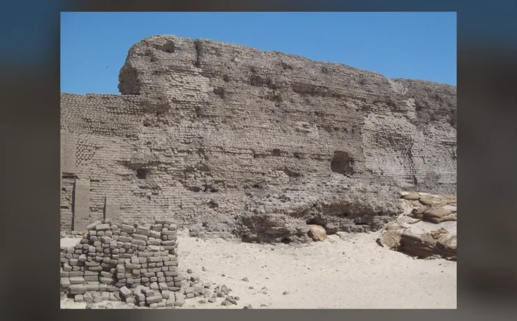
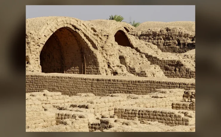
The Egyptian Ministry of Tourism and Antiquities describes the Hawara Pyramid as built from mudbrick and originally covered with white limestone. The present mound-like appearance is therefore not how the royal complex was intended to be seen. Loss of its casing and long-term erosion exposed the core to weathering, altering the outline from a formal pyramid into a heavily worn archaeological feature.
This construction choice is important for comparison with the great stone pyramids at Giza. Different periods used varying combinations of stone, brick, core construction and casing, depending on the project. Describing all Egyptian pyramids as giant solid limestone triangles misses the engineering diversity visible across dynasties. A current site photograph demonstrates the state of surviving material, while an accurate image of the original shape would require an explicitly labeled scholarly reconstruction.
The complicated route to the royal burial chamber
The ministry describes a system of passages designed to confuse intruders, ultimately approaching a burial chamber formed within a massive quartzite block. It also records a carefully sealed opening in the chamber’s roof. These elements reflect a concern with protecting a royal burial and the technical ability to work difficult stone. They are remarkable achievements within a documented architectural tradition, without requiring an alien or supernatural explanation.
Visitors should not assume that a plan of the passage system provides a present-day accessible underground trail. Preservation problems, safety and protection of the monument can restrict entry. Archaeological diagrams represent observed and inferred relationships among chambers rather than proof that additional corridors stretch indefinitely beneath Fayum. The strongest claims are those tied to measured structures, records of excavation and the original materials described by the heritage authority.
The vanished mortuary temple called the Labyrinth
South of the pyramid stood a major mortuary temple or ceremonial complex, identified with the Labyrinth praised by Greek visitors. UCL Digital Egypt links the name to Amenemhat III’s Hawara temple. The Egyptian building served the religious and commemorative world of royal kingship, while the name ‘Labyrinth’ belongs to a later Greek tradition of describing its complicated arrangement. Keeping those two identities separate helps explain how a real Egyptian monument entered ancient Mediterranean writing.
Much of the temple’s fabric has been lost through dismantling, reuse and changes to the landscape. Modern readers should not expect to walk through the vast network described by Greek accounts. An extensive original complex is historically plausible, but the exact arrangement of every lost room cannot be recovered from an attractive digital drawing alone. Excavated fragments, historic plans and architectural comparisons provide constraints on what can responsibly be proposed.
What Herodotus actually contributes to the story
The fifth-century BCE Greek historian Herodotus described a remarkable complex with interconnected courts and rooms. His account demonstrates that the monument had become famous long after the Middle Kingdom. At the same time, an ancient writer’s description is a textual source with its own rhetorical conventions, observations and limitations. It is not the same as a measured architectural survey carried out by modern archaeologists.
A key question is which parts Herodotus said he saw himself and which were reported to him. His language about the monument’s magnificence offers evidence for ancient perception, while the building’s physical form must be compared with later archaeology. Repeating the impressive reported room counts as a verified current excavation total would mistake literary testimony for an inventory of standing rooms. A more useful interpretation treats his account as one line of evidence alongside the ruins.
Strabo, later visitors and the temptation of exact room counts
The Greek geographer Strabo also described the Labyrinth in language emphasizing interconnected courts and corridors. His account helps historians trace the monument’s reputation during the ancient Mediterranean period. It does not establish that the temple in Amenemhat III’s own day looked identical in every detail to what Strabo encountered centuries later. Buildings undergo change, and descriptions serve different purposes.
Claims that excavators have already found thousands of sealed rooms because Greek authors reported such numbers are therefore unsupported. The literary descriptions may preserve memories of extensive architecture, but the archaeological record has to establish the surviving footprint and structures. Interpretive uncertainty is not a flaw in the story; it is part of how historical investigation works when a once important monument has been mostly destroyed.
Petrie’s investigations and the wider Hawara cemetery
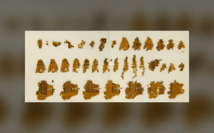
Modern excavation at Hawara became prominent through the work of Flinders Petrie and other researchers in the nineteenth and early twentieth centuries. Hawara is also associated with a large cemetery containing burials from later eras, including the Roman period. UCL describes the site as an elite burial ground for people of the Fayum in that later phase. Its famous mummy portraits belong to this much younger history and should not be attributed directly to Amenemhat III’s court.
The coexistence of Middle Kingdom royal architecture and Roman-era burial evidence creates an opportunity to study change over long periods. However, nineteenth-century excavation practices and documentation must be assessed critically, since object locations, conservation conditions and collecting histories may be incomplete. Modern museums and databases can help identify the provenance of individual finds, whereas a generic picture of a painted mummy portrait does not prove it came from the Labyrinth temple.

Groundwater, conservation and modern scientific questions
Groundwater is a significant preservation concern for Hawara, particularly for vulnerable buried structures and archaeological sediments. Modern investigations consider water tables, the character of building materials and long-term environmental change. Published research from 2024 and preservation proposals discuss the threat posed by water infiltration. The existence of such a problem is consistent with the site’s physical setting, but any claimed depth of water or present condition must be dated and attached to its study.
Conservation involves more than revealing hidden passages for photographs. Stabilizing material, managing water, documenting damage and prioritizing the protection of fragile deposits can be more important than excavation. A research initiative’s proposed reconstruction is not automatically an official discovery or a new verified floor plan. The difference between survey results, future plans and confirmed excavation finds should remain visible in reports published for an international audience.
Historical maps versus the site visitors see today
The historical illustration accompanying this article is a Lepsius-era map of Hawara, useful for understanding the history of documentation. It is not presented as a satellite scan or a map showing a newly discovered underground city. Older maps record how researchers organized the site, and their conventions can differ from those used in a modern geospatial dataset. Comparing them with current site documentation can show how interpretations and excavation priorities changed.
The other image shows the actual pyramid’s current eroded core. Taken together, they convey two different kinds of evidence: a photographic record of surviving architecture and a historical research representation. Neither image justifies filling in lost building sections with invented corridors. The most convincing illustrations of a complex site are the ones whose date, author and limitations can be explained clearly in a caption.
The Hawara and Dahshur pyramidion confusion
The Egyptian Museum in Cairo documents a basalt pyramidion of Amenemhat III discovered at Dahshur. Its decorated face contains royal and solar symbolism, but the museum’s official provenance must be retained. Attaching that object to a photograph of the Hawara mound and calling it the Hawara pyramidion is a misidentification. Two pyramids connected with one king do not mean every detached artifact belongs to both.
This distinction offers a practical example of museum method. A findspot, catalogued date, object type and scholarly attribution each contribute to provenance. Digital articles can compare related monuments but should keep original contexts linked to institutional records. Hawara deserves its own architectural narrative without borrowing the wrong tip stone merely to make the article more visually dramatic.
Planning a scholarly visit without inventing access conditions
The ministry maintains a visitor page for the Hawara Pyramid, identifying its position in Fayum and official visiting arrangements. Access to the archaeological surroundings and to internal spaces are different questions, and conditions can change. Visitors should consult the current authority record before traveling, particularly where conservation and safety are relevant. A research article is not a guarantee that the burial chamber or Labyrinth remains are open to the public.
An informed visit begins by identifying the original pyramid core, the area associated with the mortuary complex and the broader cemetery landscape. The site is less visually intact than Giza but can be more rewarding for understanding Middle Kingdom building methods and later reuse. Avoid walking into restricted excavation areas, collecting fragments or taking the literary description of the Labyrinth as a precise walking route.
What Hawara contributes to the history of Egypt
Hawara connects a major Twelfth Dynasty king to an engineering project and an extensive memorial complex whose later fame survived in Greek literature. It also reveals the challenges of studying a monument altered by quarrying, erosion and groundwater. The actual pyramid is an archaeological object; the Labyrinth is both a lost Egyptian temple and a subject of ancient descriptions. Treating those layers separately makes the story richer and more reliable.
Understanding the site also widens the narrative of Egyptian pyramid construction beyond the Fourth Dynasty at Giza. The materials, burial protection, historical setting and preservation problems are different. Through UCL’s records, official Egyptian site descriptions and museum collections, readers can examine the evidence without relying on viral claims that every unexcavated space already contains a city of secret chambers.
Evidence and uncertainty: a concise source table
| Record | Evidence | Interpretation limit |
|---|---|---|
| Amenemhat III | A Twelfth Dynasty king linked to Hawara and Dahshur pyramids | Dahshur artifacts should not be assigned to Hawara |
| Mudbrick and limestone | Original casing differed greatly from the surviving mound | Modern photograph does not reproduce the original silhouette |
| Burial passages | Complex protective approach and quartzite chamber | Do not infer endless hidden corridors |
| Greek Labyrinth accounts | Ancient writers described a grand complex | Room counts are not a measured surviving inventory |
| Lepsius historical map | Evidence of earlier archaeological documentation | Not a modern radar survey |
| Groundwater research | Preservation risk requiring technical management | A project proposal is not an excavation discovery |
Primary source records and research links
This research distinguishes named site records from nineteenth-century drawings and ancient Greek literary accounts. Images and licenses were independently checked on 4 November 2026.