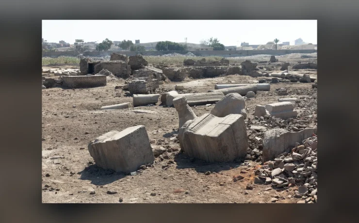
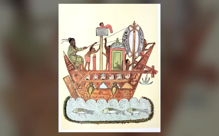
The Nilometer on Rawda Island is a remarkable surviving witness to medieval Egyptian engineering. Situated in the Nile at Cairo, its deep measuring well, stairway, carved inscriptions and central marble column helped people observe seasonal changes in river height. Before modern reservoirs made the annual flood fundamentally different, this information mattered to farming, trade, tax expectations and public ceremony. The Nilometer did not control the Nile. Its achievement was to make an unpredictable environmental process visible and measurable within an institution.
The best-preserved monumental structure is usually associated with the Abbasid caliph al-Mutawakkil in 861 CE, although measurements and earlier installations at the island preceded that rebuilding. Egypt’s Ministry of Tourism and Antiquities and UNESCO’s tentative-list account document these layers. Understanding their different dates is part of studying the site rather than a problem to conceal. This guide reconstructs the instrument’s historical functions, technical design, political context and long afterlife without describing a later restoration as an untouched Abbasid original.
Why measuring the Nile mattered
Before modern large-scale river regulation, seasonal floodwaters profoundly affected the agricultural cycle. Sufficient water could support cultivation and replenish fields; an inadequate rise risked crop failure, while excessive flooding could damage settlements and infrastructure. The consequences varied by district and depended on local canal maintenance, embankments, soil and timing. One number recorded in Cairo never represented every farmer’s individual circumstances. Yet a public reading could provide a widely understood signal of changing environmental conditions and influence the decisions of administrators responsible for a complex agricultural society.
The instrument was therefore part of an information system. Measuring a flood is different from accurately forecasting every harvest. Even if the rising river reached a familiar mark, the result in one locality might depend on the condition of its irrigation works. Medieval sources sometimes associate particular cubit thresholds with prosperity or shortage, but such correlations should not be repeated as mathematical guarantees. The monument teaches a broader principle: societies developed procedures to understand risks that they could not eliminate. In a country where the river connected villages, food markets and government revenue, that knowledge carried political significance.
The Rawda location and the earlier measuring tradition
Rawda, also written Roda or Rhoda, occupies a useful position in the Nile beside historic Cairo. UNESCO’s tentative-list documentation discusses work on an earlier measuring facility around 715 CE, after the Arab conquest. It also traces later rebuilding and repair. This layered chronology is essential, because popular guides sometimes assign the whole site’s origin to a single caliph. One date can refer to an early installation and another to the substantial stone structure visible today. Across the medieval centuries, observation of the river remained useful even as the government responsible for Cairo changed.
It is important to distinguish a fixed measuring site from an unbroken original set of stones. Floodwater, masonry decay and changing administrative needs encouraged intervention. UNESCO records phases connected with Abbasid and Fatimid times and subsequently with rulers under other dynasties. The persistence of a location does not mean every stair, inscription or cupola belongs to its earliest use. Researchers compare written descriptions, measured drawings and physical features to understand those changes. A photograph alone can show architecture, but it cannot provide the construction history of every part visible within a frame.
The Abbasid rebuilding of 861 CE
The Egyptian Ministry of Tourism and Antiquities attributes the surviving Nilometer to the order of the Abbasid caliph al-Mutawakkil in 247 AH, or 861 CE. This places the monument within the Abbasid political world but also within a local Egyptian tradition of water measurement. Cairo’s early Islamic settlements and institutions depended on the river long before modern hydraulics. The construction of a monumental measuring well gave an established activity durable architectural form. Engineering competence, the authority of officials and the city’s economic priorities met in one building.
Assigning a monument to a caliph does not mean he personally designed the shaft or read the scale. Building and operating such a device required engineers, masons, inspectors and custodians. UNESCO’s account mentions the engineer Ahmed ibn Muhammad al-Hasib in relation to major works and traditions about officials charged with measuring the flood. Different writers transliterate those names in different ways. Their importance is institutional: the structure embodies practical skills and an office of trusted observation. Study should avoid inventing speeches or royal scenes for which no contemporary eyewitness record exists.
The well, marble column and measuring marks
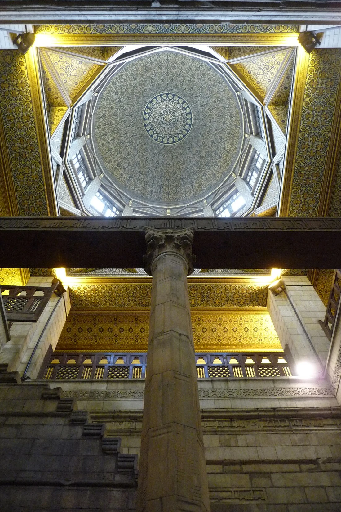
The central arrangement is architectural and technical at the same time. The ministry describes a stone-lined well, rectangular toward the top and circular below, with an octagonal marble column marked with measuring divisions. It gives the column a length of nineteen cubits. A stairway runs down the interior, allowing close access to the measuring environment. The geometry was not arbitrary decoration; it organised the relation between water, fixed stone surfaces and a scale that trained observers could read. Photographs of the inner shaft make this function easier to understand than an external view of the building.
A cubit is a historically specific unit, and careless conversion into modern metres can create false precision. Measurement standards and conventions varied by time and region. Readers should therefore begin with the scale as described by responsible architectural studies before assigning exact modern equivalents to every mark. The presence of a column does not itself prove that all annual records survive or that measurements were always made in exactly the same way. The device provided a physical reference point; historical interpretation also needs written accounts, institutional histories and evidence of maintenance.
Inscriptions and the meaning of water
The walls of the Nilometer contain inscriptions, including Qur’anic references to water, vegetation and prosperity, according to the Egyptian ministry’s description. Their presence makes a useful comparison between modern expectations and medieval architectural practice. A technical instrument could be surrounded by language of divine provision without losing its practical purpose. Inscriptions framed the flood as an event with moral, religious and social significance, not simply as a number. This combination matters for interpreting the monument as part of a lived urban landscape, where engineering and ceremonial authority often overlapped.
An inscription still needs contextual reading. It does not tell historians the private conviction of every operator or prove that religious ritual caused the water to rise. It represents a selected public message. The monument’s combination of hydraulic measurement and religious language demonstrates how a state made an environmental process intelligible within its existing cultural framework. Students should examine where texts appear in relation to the stairway and shaft. A modern caption that shows only the column but ignores the inscriptions has removed an important part of the evidence.
Flood levels, taxation and government decisions
The ministry identifies two major purposes of nilometers: assessing flood conditions so irrigation infrastructure could be prepared and informing expectations relevant to taxation. This reveals the connection between environmental measurement and state finance. Agriculture generated resources that supported institutions, cities and administration. Officials needed to estimate what river conditions might mean for cultivation. A publicly recognised reading supplied evidence that could be used in discussion and planning. That does not make the system a perfectly automatic process: actual assessment of tax depended on law, place, crops and the decisions of people.
UNESCO emphasises the relationship between flood readings, food prices and state revenue. Such connections help explain why the Nilometer was considered politically important rather than a private technical curiosity. However, statements that a single water height dictated an identical tax rate throughout Egypt oversimplify complex fiscal systems. Measurement interacted with information from canals, villages and markets. Like any dataset, it could be interpreted or mobilised in competing ways. Medieval officials’ interest in Nile levels shows an early effort to govern ecological uncertainty, not an ability to eliminate it.
Skilled observers and the service of measurement
The usefulness of a measuring column depended on people who knew how to read, preserve and communicate its values. UNESCO’s historical account includes the name Abdallah al-Raddad and a tradition of his family holding responsibility for the measuring service over generations. The evidence should be read within its documentary context, not turned into an unverified family legend. It nevertheless reminds us that technical monuments worked through institutions. Custodians maintained routines, officials reported figures, and administrators had to decide how those readings should inform policy.
A useful comparison is a modern weather station. The apparatus may be prominent in photographs, but its social importance depends on trusted observations, records and communication. The Nilometer was not identical to a meteorological station, yet it shares this dependence on procedure. Measuring mistakes, structural damage or disputed readings could affect confidence in the process. Evidence for every such incident has not survived, so historians should not invent a catalogue of scandals. The broader lesson is that medieval engineering involved institutional continuity as well as physical structures that required preservation.
Ceremonies of the inundation
Cairo’s flood announcements became associated with public celebration. The ministry records a seven-day festive tradition attended at different times by senior rulers and officials, stretching from the medieval period toward the end of the nineteenth century. Ceremony translated an environmental development into shared urban experience. Processions and official participation could signal hope for sufficient harvests and make government involvement visible. The river’s movement affected people beyond those who physically visited the well, so a public narrative had an audience larger than the measurement staff.
Descriptions of festivities must still be checked against their dates. Rituals changed across Fatimid, Mamluk and Ottoman rule. The same name for a celebration need not imply an identical procession in every century. Moreover, a festival does not mean all farmers and townspeople were equally secure. An officially encouraging level could coexist with problems elsewhere. Reading ceremonial descriptions alongside economic evidence creates a more humane account of the flood: joy and anxiety, religious symbolism and practical observation all belonged to the same environmental world.
Medieval foundations and later restorations
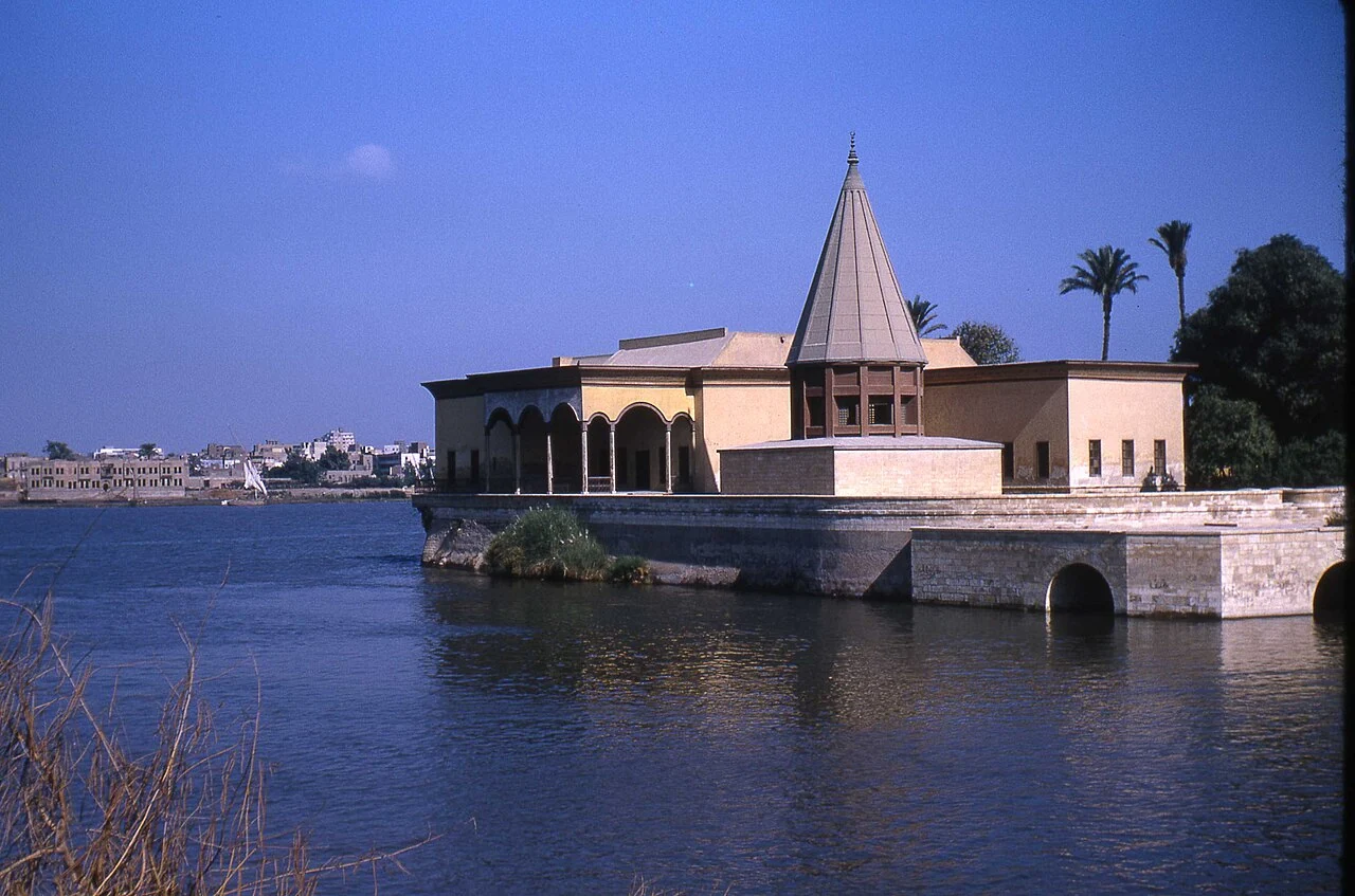
The Nilometer has lived through many governments. Earlier measurements, the Abbasid rebuilding, Fatimid work and subsequent restorations form a chronological sequence that should not be flattened. UNESCO’s nomination account mentions alterations through different centuries, including Ottoman interventions. That breadth makes Rawda a place where visitors can study the layered history of Egypt through one monument. An Ottoman-period repair is part of its story but does not turn the original measuring scheme into an Ottoman invention. Similarly, a later enclosing structure cannot simply be labelled Abbasid because it covers an earlier well.
Conservation requires distinguishing original fabric from repaired stone, replacement surfaces and later architecture. A photograph of an apparently intact interior cannot prove that no restoration occurred. Modern historians use measured plans, inscriptions and old travel descriptions as checks on what visitors can see. The status of Rawda on UNESCO’s tentative list also deserves accurate wording: the tentative list is a preliminary national inventory, not an automatic designation of World Heritage status. This distinction matters in heritage reporting because an impressive monument does not justify misleading claims about official recognition.
The Nilometer and the wider city of Cairo
The monument belongs to a broader Nile landscape including Fustat’s beginnings, river trade, construction and later urban growth. Kemet Vault’s history of Fustat’s foundation provides the early Islamic urban context. Its study of Fatimid shipyards and Rawda examines another role played by the river. Neither is a duplicate Nilometer page. These connections help readers see measurement, shipping and commerce as related uses of a shared environment rather than disconnected curiosities.
Students visiting Cairo can use the structure as a case study in historical engineering. Start with the shaft and scale, observe access routes and the inscription surfaces, then consider what data officials sought. Ask which elements are dated to 861 and which are later. Compare that world to Egypt after the construction of major modern dams, while remembering that technological change affected people differently. The Nilometer shows that water management has a long history of measurement and decision-making, and that tools can shape public imagination even when they cannot control nature.
Archaeological photographs and reading the sources
The Egyptian Ministry of Tourism and Antiquities monument entry gives the principal structural description and Abbasid date. The UNESCO Rawda Nilometer tentative-list account describes the earlier site, restorations and civic significance. The two photographs included here show the extant interior and a documented twentieth-century exterior view, not the flood ceremony of 861. Their dates and provenances must remain visible in the captions so the reader does not confuse photographic evidence for ancient imagery. Check the ministry’s live visitor information before planning a trip, as admission arrangements can change.