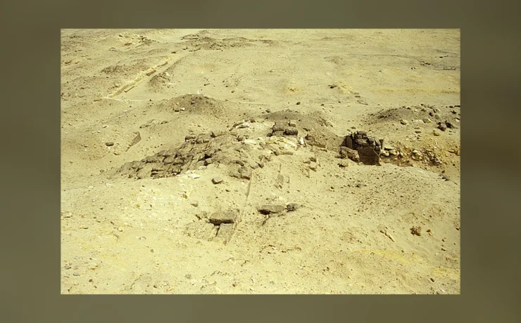
There is no fortress left to walk around at Buhen. Its massive walls, once set beside the Nile in Lower Nubia, lie beneath the waters created by the Aswan High Dam. Yet we know its outline in extraordinary detail. Archaeologists excavated the gates, defensive ditches, bastions and buildings shortly before the site disappeared.
That makes Buhen a story about two kinds of power: the Egyptian state that built and staffed a fortified frontier, and the twentieth-century rescue campaign that tried to record what the new reservoir would erase. It also raises a question that a simple map rarely answers: what did a fortress on the Nile actually control?
A fortified place built into a busy landscape
Buhen stood on the west bank of the Nile in what is now northern Sudan. The Egypt Exploration Society’s site history describes an Old Kingdom settlement in the area, where copper ore was worked and transported north. The great Middle Kingdom fortress came later, during the reigns of Senwosret I and Senwosret III in the Twelfth Dynasty.
The sequence matters. Buhen was not created on an empty desert frontier and used for one brief campaign. Different communities occupied the area over time. The fortress belonged to a larger system of royal administration, river movement, military presence and exchange between Egypt and Nubia. Later New Kingdom rulers reused the place, and worship of earlier kings became part of its history.
We should be careful with the word border. A stronghold could monitor travelers, supplies and access to river routes without creating a modern fixed national boundary. The position of a garrison tells us what Egyptian authorities wanted to control; it does not give us the thoughts or loyalties of everybody living nearby.
What the excavated walls reveal
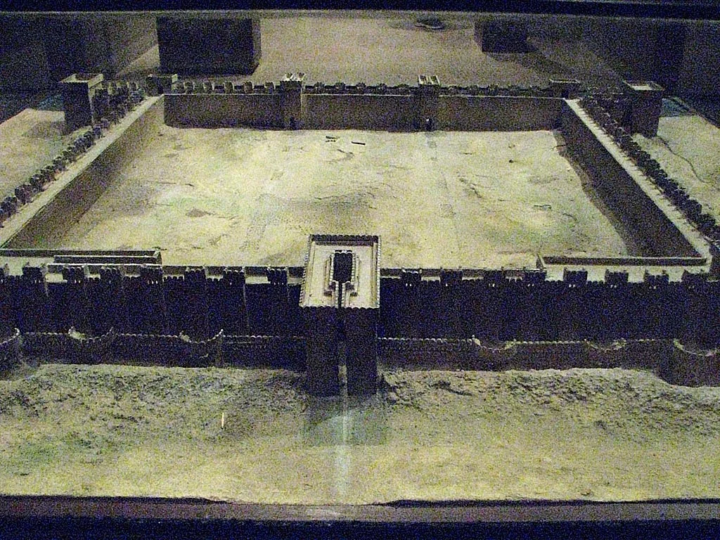
Photographs and survey drawings show a formidable plan: fortified enclosures, bastions, gateways and an inner defended area. Those details are not invented reconstructions of how an Egyptian fortress ought to look. They were recorded by excavators who measured the surviving mudbrick structures and the spaces between them.
The first image here is a model in the Nubian Museum at Aswan. It helps visitors visualize the fortress’s plan but must not be mistaken for a modern photograph of the standing ancient walls. The site itself is submerged.
It is tempting to imagine every tower continuously manned by soldiers ready for battle. Archaeology offers a more complicated picture. A fortress required routine upkeep, food supplies, water, storage and places to live. Its architecture could discourage attack, but also regulate movement and make the presence of royal authority visible to those approaching the Nile.
The frontier was a network, not one isolated fort
Buhen belonged to a series of fortified sites in Nubia. The Middle Kingdom kings were concerned with routes and resources as well as political influence. Sites at Semna and elsewhere worked within this wider geography. Our Senusret III frontier study examines the ruler’s border inscriptions and what they reveal about royal policy.
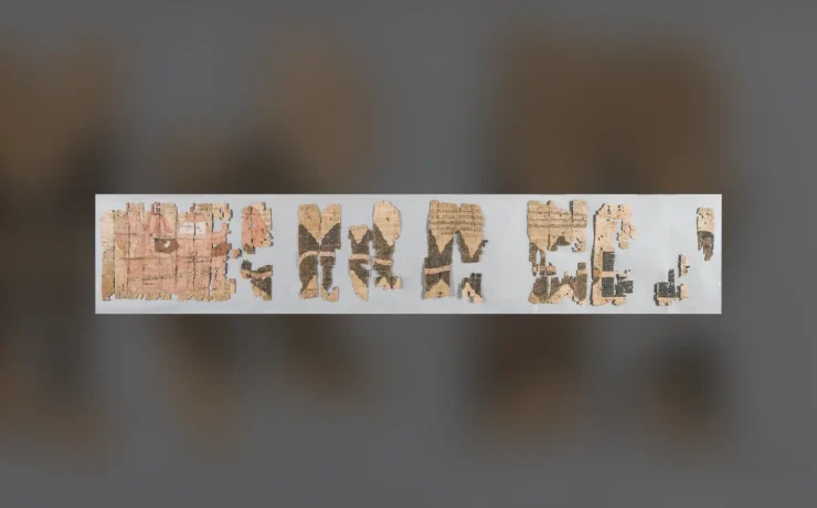
One unusually revealing source is the collection known as the Semna dispatches. These papyri report movements and observations at the frontier. They show that Egyptian officials were interested in people crossing or passing through the area and in communicating information along the line of forts.
But the dispatches are not a daily diary written inside Buhen itself. They are evidence for the broader frontier apparatus. Claiming that every recorded movement happened at Buhen would erase the difference between a regional system and one particular fortress.
A surviving object gives the frontier a human face
Not every artifact from the area celebrates an Egyptian ruler. The second image shows an ancient representation identified in the Commons record as a Nubian king holding a bow, associated with Buhen and held in the museum collection of the University of Chicago. The work has been dated to around 1650 BCE, a period that complicates any simple account of permanent, unquestioned Egyptian control.
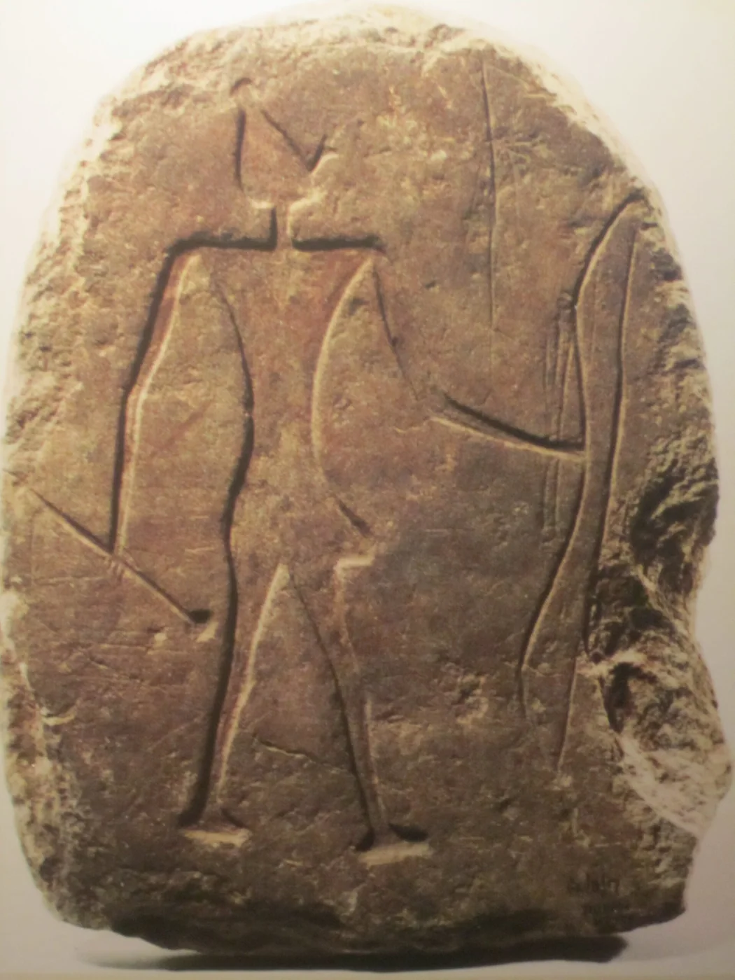
Even when the administrative record speaks mostly in the language of Egyptian officials, the region was home to Nubian societies with their own political histories. A fortress does not transform the people beyond its walls into passive figures in someone else’s story. The evidence needs to be read with an awareness of both Egyptian aims and local agency.
How a threatened excavation became rescue archaeology
The Egypt Exploration Society records earlier work at Buhen in 1909–10 by the University of Pennsylvania expedition. Walter Bryan Emery returned in 1957, after work in Egypt was interrupted by the Suez crisis. His team found that the previous excavations had not fully exposed the outer defenses. The new work revealed the size and complexity of the fortified perimeter.
Then came the looming rise of the reservoir. In 1960, UNESCO launched the international campaign to rescue monuments and archaeological sites threatened by the High Dam. Buhen’s excavation changed from research with an open future to an urgent attempt to document the past before it disappeared. The EES archive account preserves excavation history, plans and field photographs from that effort.
Not everything could be moved. Parts of Buhen’s later temple were dismantled and relocated to the Sudan National Museum in Khartoum, but the great mudbrick defenses remained at the original location and were submerged in 1964. The result is a divide between material that can still be studied in museums and a site now accessible primarily through plans, notes, photographs and archived finds.
Why the old excavation files now matter so much
The surviving records contain more than a picturesque outline of the vanished walls. Excavation drawings document relationships among gates, ditches, houses and later structures. Photographs show where the archaeologists found objects. Museum catalogues preserve information about pieces that have been removed from their original setting.
That evidence is essential when a site can no longer be checked easily in the landscape. An error in a caption or an unexamined assumption about which building belonged to which period may be difficult to correct without returning to the archives. The EES records and the publications of Emery, Ricardo Caminos and other excavators therefore continue to shape research on Buhen.
| Evidence | What it can tell us | What it cannot show alone |
|---|---|---|
| Fortress plan and defensive walls | Layout, building phases and movement through the complex | The precise duties of every person who lived there |
| Semna dispatches | How frontier officials recorded and shared observations | That each reported journey occurred at Buhen |
| Museum objects from the region | Artistic, political and religious evidence | The complete experience of local Nubian societies |
| Rescue excavation archive | The fortress before submersion and the context of recovered finds | A substitute for every detail lost below the reservoir |
Buhen cannot now offer the experience of walking through a surviving ancient frontier fortress. It offers something more demanding: the opportunity to reconstruct a place through the work of people who knew they were recording it for the last time. The EES account is the best place to begin that investigation.